

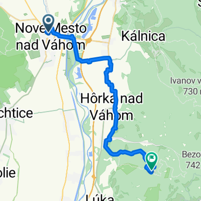
Nove Mesto nad Vahom - Myjava - Senica
A cycling route starting in Nové Mesto nad Váhom, Trenčín Region, Slovakia.
Overview
About this route
Velmi pekny vylet napriec Myjavskou pahorkatinou a kopalickym krajom. Cestou mozno vidiet Cachticky a Brancsky hrad, Kunovsku priehradu atd atd...
- -:--
- Duration
- 57.3 km
- Distance
- 807 m
- Ascent
- 797 m
- Descent
- ---
- Avg. speed
- 444 m
- Max. altitude
Route quality
Waytypes & surfaces along the route
Waytypes
Busy road
30.1 km
(53 %)
Road
18.9 km
(33 %)
Surfaces
Paved
37.2 km
(65 %)
Unpaved
0.8 km
(1 %)
Asphalt
37.2 km
(65 %)
Gravel
0.8 km
(1 %)
Undefined
19.3 km
(34 %)
Route highlights
Points of interest along the route

Point of interest after 10.5 km
Vrch Velky Plesivec, v popredi vidiet aj Cachticky hrad

Point of interest after 13.2 km
Stara Tura

Point of interest after 20.1 km
Pohlad na myjavske kopanice

Point of interest after 25.7 km
Myjavsky kostol

Point of interest after 40.9 km
Hrad Branc, pod nim obec Podzamok

Point of interest after 41.3 km
Myjavska pahorkatina

Point of interest after 42.5 km
Pohlad na konciace Biele Karpaty a zacinajucu Zahorsku nizinu

Point of interest after 47.5 km
Obec Sobotiste

Point of interest after 50.3 km
Kunovska priehrada

Point of interest after 54.3 km
Senicsky kostol
Continue with Bikemap
Use, edit, or download this cycling route
You would like to ride Nove Mesto nad Vahom - Myjava - Senica or customize it for your own trip? Here is what you can do with this Bikemap route:
Free features
- Save this route as favorite or in collections
- Copy & plan your own version of this route
- Sync your route with Garmin or Wahoo
Premium features
Free trial for 3 days, or one-time payment. More about Bikemap Premium.
- Navigate this route on iOS & Android
- Export a GPX / KML file of this route
- Create your custom printout (try it for free)
- Download this route for offline navigation
Discover more Premium features.
Get Bikemap PremiumFrom our community
Other popular routes starting in Nové Mesto nad Váhom
 Nove Mesto nad Vahom - Myjava - Senica
- Distance
- 57.3 km
- Ascent
- 807 m
- Descent
- 797 m
- Location
- Nové Mesto nad Váhom, Trenčín Region, Slovakia
 NMnV - hrad Tematin
- Distance
- 21.4 km
- Ascent
- 543 m
- Descent
- 167 m
- Location
- Nové Mesto nad Váhom, Trenčín Region, Slovakia
 Nové Mesto n.Váhom - Salašky
- Distance
- 12.3 km
- Ascent
- 432 m
- Descent
- 433 m
- Location
- Nové Mesto nad Váhom, Trenčín Region, Slovakia
 Nové Mesto n. Váhom - Beckov - Lašid
- Distance
- 10.8 km
- Ascent
- 280 m
- Descent
- 82 m
- Location
- Nové Mesto nad Váhom, Trenčín Region, Slovakia
 N.Mesto n.Váhom- Nová Bošáca -Březno
- Distance
- 23 km
- Ascent
- 286 m
- Descent
- 31 m
- Location
- Nové Mesto nad Váhom, Trenčín Region, Slovakia
 Ulica Ondreja Plachého 156/24, Nové Mesto nad Váhom až Severná ulica 2412/38, Nové Mesto nad Váhom
- Distance
- 18.2 km
- Ascent
- 481 m
- Descent
- 480 m
- Location
- Nové Mesto nad Váhom, Trenčín Region, Slovakia
 Nové Mesto n.Váhom - Bošáca - Dolné Sŕnie
- Distance
- 20.7 km
- Ascent
- 121 m
- Descent
- 121 m
- Location
- Nové Mesto nad Váhom, Trenčín Region, Slovakia
 NM-Morav. Lieskové -Bzince p. Javorinou
- Distance
- 17.5 km
- Ascent
- 100 m
- Descent
- 99 m
- Location
- Nové Mesto nad Váhom, Trenčín Region, Slovakia
Open it in the app