

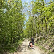
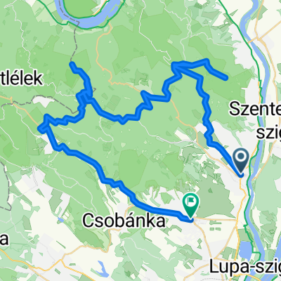
Szentendre-Esztergom
A cycling route starting in Szentendre, Pest County, Hungary.
Overview
About this route
Tavaszköszöntő Bebiciklizés
- -:--
- Duration
- 47.1 km
- Distance
- 170 m
- Ascent
- 170 m
- Descent
- ---
- Avg. speed
- ---
- Max. altitude

Route quality
Waytypes & surfaces along the route
Waytypes
Quiet road
4.7 km
(10 %)
Pedestrian area
2.8 km
(6 %)
Surfaces
Paved
29.7 km
(63 %)
Unpaved
1.4 km
(3 %)
Asphalt
29.7 km
(63 %)
Ground
0.9 km
(2 %)
Continue with Bikemap
Use, edit, or download this cycling route
You would like to ride Szentendre-Esztergom or customize it for your own trip? Here is what you can do with this Bikemap route:
Free features
- Save this route as favorite or in collections
- Copy & plan your own version of this route
- Sync your route with Garmin or Wahoo
Premium features
Free trial for 3 days, or one-time payment. More about Bikemap Premium.
- Navigate this route on iOS & Android
- Export a GPX / KML file of this route
- Create your custom printout (try it for free)
- Download this route for offline navigation
Discover more Premium features.
Get Bikemap PremiumFrom our community
Other popular routes starting in Szentendre
 pap-rét melegítő
- Distance
- 18.6 km
- Ascent
- 394 m
- Descent
- 390 m
- Location
- Szentendre, Pest County, Hungary
 Szentendre - Csobánka - Budakalász
- Distance
- 37.1 km
- Ascent
- 351 m
- Descent
- 364 m
- Location
- Szentendre, Pest County, Hungary
 szentendre-prédikálószék-pilisszentlászló-szentendre
- Distance
- 43.6 km
- Ascent
- 1,371 m
- Descent
- 1,482 m
- Location
- Szentendre, Pest County, Hungary
 Szentendre - Pap-rét - Vörös-kő - Prédikálószék - Kakas-hegy - Pomáz
- Distance
- 58.2 km
- Ascent
- 1,181 m
- Descent
- 1,180 m
- Location
- Szentendre, Pest County, Hungary
 Szentendre - Budapest
- Distance
- 26.9 km
- Ascent
- 64 m
- Descent
- 56 m
- Location
- Szentendre, Pest County, Hungary
 Vércse próbanap
- Distance
- 81.8 km
- Ascent
- 993 m
- Descent
- 877 m
- Location
- Szentendre, Pest County, Hungary
 Zebegényi rétes nóta
- Distance
- 127.2 km
- Ascent
- 152 m
- Descent
- 152 m
- Location
- Szentendre, Pest County, Hungary
 Kedvenc köröm, 123 km
- Distance
- 119.1 km
- Ascent
- 678 m
- Descent
- 678 m
- Location
- Szentendre, Pest County, Hungary
Open it in the app