Zuidelijke rivierenroute
A cycling route starting in Šatov, South Moravian, Czechia.
Overview
About this route
Nice bike trail along Dyje and Morava river, along Lednice-Valtice, Kroměříž and Olomouc UNESCO memorials through land of wine and trandition, connection three countries - Czech republic, Slovakia and Austria.
- -:--
- Duration
- 268.4 km
- Distance
- 287 m
- Ascent
- 308 m
- Descent
- ---
- Avg. speed
- ---
- Max. altitude
Route quality
Waytypes & surfaces along the route
Waytypes
Road
45.6 km
(17 %)
Quiet road
45.6 km
(17 %)
Surfaces
Paved
166.4 km
(62 %)
Unpaved
10.7 km
(4 %)
Asphalt
158.3 km
(59 %)
Paved (undefined)
5.4 km
(2 %)
Route highlights
Points of interest along the route
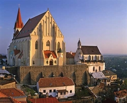
Photo after 0 km
Znojmo
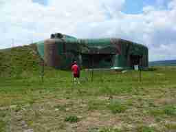
Photo after 0 km
Šatov fortification
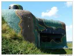
Photo after 0.1 km
Cold war fortification

Photo after 2.9 km
Iron curtain

Photo after 7.1 km
Retz windmill

Photo after 7.2 km
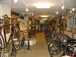
Photo after 8.1 km
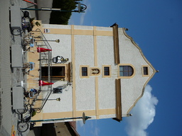
Photo after 18 km

Photo after 22.2 km
Austrian wine cellars

Photo after 28.8 km
Seefeld

Photo after 31.3 km
Seefeld

Photo after 33.2 km

Photo after 43.5 km
Rotund
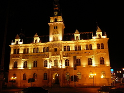
Photo after 57.6 km
Laa and der Thaya

Photo after 69 km
crossing the border

Photo after 70.5 km
Galgenberg

Photo after 84.1 km
Mikulov

Photo after 84.9 km
Mikulov

Photo after 88.1 km
Iron curtain roads

Photo after 95.7 km
Reisten
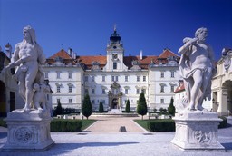
Photo after 97.7 km
Valtice

Photo after 97.7 km
Rendezvous

Photo after 97.7 km
St. Hubert

Photo after 102.3 km
Lednice

Photo after 110.3 km
Jan´s castle
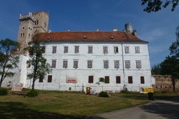
Photo after 116.6 km
Břeclav

Photo after 122.1 km
Pohansko

Photo after 134.1 km
Dolní Morava nature protected area
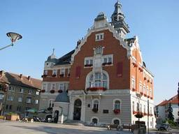
Photo after 148.9 km
Hodonín

Photo after 154.6 km
Holíč
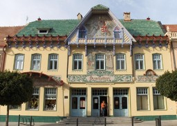
Photo after 159.8 km
Skalica

Photo after 163.1 km
Skalica

Photo after 166.3 km
Plže

Photo after 169.6 km
Strážnice open air museum

Photo after 170.9 km
Strážnice
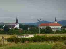
Photo after 183.4 km
Uherský Ostroh

Photo after 185.2 km
Uherský Ostroh

Photo after 198.5 km
Staré Město Lighthouse

Photo after 201.3 km
Uherské Hradiště

Photo after 207.3 km
Biking along the Baťa canal

Photo after 213.9 km
chateau Napajedla

Photo after 222.7 km
Kvasice

Photo after 229.6 km
Kroměříž

Photo after 231.2 km
Kroměříž

Photo after 237.8 km
Chropyně

Photo after 249.7 km
Tovačov

Photo after 256.6 km
Dub nad Moravou

Photo after 267.6 km
Olomouc

Photo after 268.1 km
Olomouc
Continue with Bikemap
Use, edit, or download this cycling route
You would like to ride Zuidelijke rivierenroute or customize it for your own trip? Here is what you can do with this Bikemap route:
Free features
- Save this route as favorite or in collections
- Copy & plan your own version of this route
- Split it into stages to create a multi-day tour
- Sync your route with Garmin or Wahoo
Premium features
Free trial for 3 days, or one-time payment. More about Bikemap Premium.
- Navigate this route on iOS & Android
- Export a GPX / KML file of this route
- Create your custom printout (try it for free)
- Download this route for offline navigation
Discover more Premium features.
Get Bikemap PremiumFrom our community
Other popular routes starting in Šatov
 Zuidelijke rivierenroute
- Distance
- 268.4 km
- Ascent
- 287 m
- Descent
- 308 m
- Location
- Šatov, South Moravian, Czechia
 MORAVA-9.den-23.7.13
- Distance
- 29.4 km
- Ascent
- 545 m
- Descent
- 372 m
- Location
- Šatov, South Moravian, Czechia
 Hnanice-Lukov-Čížov-Hardegg-Hnanice
- Distance
- 38.4 km
- Ascent
- 582 m
- Descent
- 582 m
- Location
- Šatov, South Moravian, Czechia
 Eiserner Vorhang (overview): Satov - Gmünd
- Distance
- 165.4 km
- Ascent
- 1,091 m
- Descent
- 842 m
- Location
- Šatov, South Moravian, Czechia
 EV13 3. Tag: Hardegg - Retz
- Distance
- 42.5 km
- Ascent
- 621 m
- Descent
- 662 m
- Location
- Šatov, South Moravian, Czechia
 Hardegg - Retz
- Distance
- 16.1 km
- Ascent
- 243 m
- Descent
- 295 m
- Location
- Šatov, South Moravian, Czechia
 Wine and Bike Trails
- Distance
- 226.5 km
- Ascent
- 567 m
- Descent
- 660 m
- Location
- Šatov, South Moravian, Czechia
 1397/36
- Distance
- 44.5 km
- Ascent
- 458 m
- Descent
- 458 m
- Location
- Šatov, South Moravian, Czechia
Open it in the app

