

Rhönrunde mit Weitblick 1
A cycling route starting in Schleid, Thuringia, Germany.
Overview
About this route
<p>
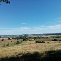
The start of the tour is in Motzlar, Thuringia. Following the Ulstertal cycling path to Buttlar. Then over Bermbach and Öchsen to Dermbach. The first destination of the stage is the high Geba with about 700 m of elevation gain. Further along via Ostheim to Ehrenberg, where it goes steeply uphill. Then a steady downhill through Wüstensachsen, Hilders, Tann back to Motzlar.</p>
<p>
</p>
<p>
</p>
Translated, show original (German)- -:--
- Duration
- 128.7 km
- Distance
- 1,291 m
- Ascent
- 1,291 m
- Descent
- ---
- Avg. speed
- ---
- Max. altitude

Route quality
Waytypes & surfaces along the route
Waytypes
Road
43.7 km
(34 %)
Quiet road
6.4 km
(5 %)
Surfaces
Paved
88.8 km
(69 %)
Asphalt
86.2 km
(67 %)
Paved (undefined)
2.6 km
(2 %)
Undefined
39.9 km
(31 %)
Continue with Bikemap
Use, edit, or download this cycling route
You would like to ride Rhönrunde mit Weitblick 1 or customize it for your own trip? Here is what you can do with this Bikemap route:
Free features
- Save this route as favorite or in collections
- Copy & plan your own version of this route
- Split it into stages to create a multi-day tour
- Sync your route with Garmin or Wahoo
Premium features
Free trial for 3 days, or one-time payment. More about Bikemap Premium.
- Navigate this route on iOS & Android
- Export a GPX / KML file of this route
- Create your custom printout (try it for free)
- Download this route for offline navigation
Discover more Premium features.
Get Bikemap PremiumFrom our community
Other popular routes starting in Schleid
 Motzlar - Kuhberg - Habelberg - Motzlar
- Distance
- 34 km
- Ascent
- 537 m
- Descent
- 537 m
- Location
- Schleid, Thuringia, Germany
 Rhönrunde mit Weitblick 1
- Distance
- 128.7 km
- Ascent
- 1,291 m
- Descent
- 1,291 m
- Location
- Schleid, Thuringia, Germany
 Schleid Cycling
- Distance
- 92 km
- Ascent
- 394 m
- Descent
- 522 m
- Location
- Schleid, Thuringia, Germany
 Recovered Route
- Distance
- 37.9 km
- Ascent
- 931 m
- Descent
- 320 m
- Location
- Schleid, Thuringia, Germany
 Tann-Frankenheim-Fladungen-Hohe Geba-Kaltennordheim
- Distance
- 90.4 km
- Ascent
- 1,453 m
- Descent
- 1,453 m
- Location
- Schleid, Thuringia, Germany
 Ketten Boxberg
- Distance
- 16.9 km
- Ascent
- 443 m
- Descent
- 443 m
- Location
- Schleid, Thuringia, Germany
 Druch die thueringische Rhoen
- Distance
- 116.5 km
- Ascent
- 1,670 m
- Descent
- 1,670 m
- Location
- Schleid, Thuringia, Germany
 Rhönrunde mit Weitblick 2
- Distance
- 107.7 km
- Ascent
- 1,679 m
- Descent
- 1,679 m
- Location
- Schleid, Thuringia, Germany
Open it in the app