

Part 2: Bike Ride 5-28-09
A cycling route starting in Eldersburg, Maryland, United States.
Overview
About this route
Generally more flat on way back once on Winands Road. Roads are paved and wider. However watch cars, jerks ride in them. General good ride.
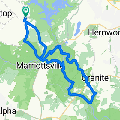
Both part 1 and 2 took 1 hour and 45 minutes to ride.
- -:--
- Duration
- 14.7 km
- Distance
- 136 m
- Ascent
- 120 m
- Descent
- ---
- Avg. speed
- 200 m
- Max. altitude

Route quality
Waytypes & surfaces along the route
Waytypes
Road
6.4 km
(44 %)
Busy road
4.9 km
(33 %)
Surfaces
Paved
9 km
(61 %)
Unpaved
0.6 km
(4 %)
Asphalt
9 km
(61 %)
Unpaved (undefined)
0.6 km
(4 %)
Undefined
5.2 km
(35 %)
Continue with Bikemap
Use, edit, or download this cycling route
You would like to ride Part 2: Bike Ride 5-28-09 or customize it for your own trip? Here is what you can do with this Bikemap route:
Free features
- Save this route as favorite or in collections
- Copy & plan your own version of this route
- Sync your route with Garmin or Wahoo
Premium features
Free trial for 3 days, or one-time payment. More about Bikemap Premium.
- Navigate this route on iOS & Android
- Export a GPX / KML file of this route
- Create your custom printout (try it for free)
- Download this route for offline navigation
Discover more Premium features.
Get Bikemap PremiumFrom our community
Other popular routes starting in Eldersburg
 6004–6020 Kennard Ct, Sykesville to 10101 Frederick Rd, Ellicott City
- Distance
- 20.6 km
- Ascent
- 173 m
- Descent
- 237 m
- Location
- Eldersburg, Maryland, United States
 macbeth to slack road
- Distance
- 9.1 km
- Ascent
- 106 m
- Descent
- 104 m
- Location
- Eldersburg, Maryland, United States
 Ridge Hernwood Thru Trail
- Distance
- 26.7 km
- Ascent
- 417 m
- Descent
- 377 m
- Location
- Eldersburg, Maryland, United States
 Part 2: Bike Ride 5-28-09
- Distance
- 14.7 km
- Ascent
- 136 m
- Descent
- 120 m
- Location
- Eldersburg, Maryland, United States
 Raincliffe Sykesville Eldersburg West
- Distance
- 29.8 km
- Ascent
- 333 m
- Descent
- 349 m
- Location
- Eldersburg, Maryland, United States
 2025-07-26 - Plantation - Church - Davis - Thru
- Distance
- 24.6 km
- Ascent
- 478 m
- Descent
- 436 m
- Location
- Eldersburg, Maryland, United States
 Trails to Dam Road with shortcut to Ridge
- Distance
- 16.1 km
- Ascent
- 365 m
- Descent
- 324 m
- Location
- Eldersburg, Maryland, United States
 1956 Granite Point Terr, Marriottsville to 16803 Yeoho Rd, Sparks Glencoe
- Distance
- 39.3 km
- Ascent
- 766 m
- Descent
- 750 m
- Location
- Eldersburg, Maryland, United States
Open it in the app