

Tag2.0_Viry-BelleyFR
A cycling route starting in Viry, Auvergne-Rhône-Alpes, France.
Overview
About this route
Monday, 20.05.2013
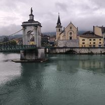
From Seyssel D991 to Belley
- -:--
- Duration
- 63.1 km
- Distance
- 302 m
- Ascent
- 502 m
- Descent
- ---
- Avg. speed
- ---
- Max. altitude
Continue with Bikemap
Use, edit, or download this cycling route
You would like to ride Tag2.0_Viry-BelleyFR or customize it for your own trip? Here is what you can do with this Bikemap route:
Free features
- Save this route as favorite or in collections
- Copy & plan your own version of this route
- Sync your route with Garmin or Wahoo
Premium features
Free trial for 3 days, or one-time payment. More about Bikemap Premium.
- Navigate this route on iOS & Android
- Export a GPX / KML file of this route
- Create your custom printout (try it for free)
- Download this route for offline navigation
Discover more Premium features.
Get Bikemap PremiumFrom our community
Other popular routes starting in Viry
 Salève X 2
- Distance
- 74.5 km
- Ascent
- 1,804 m
- Descent
- 1,804 m
- Location
- Viry, Auvergne-Rhône-Alpes, France
 Viry Accacias
- Distance
- 15.7 km
- Ascent
- 23 m
- Descent
- 191 m
- Location
- Viry, Auvergne-Rhône-Alpes, France
 Tour dans la campagne genevoise
- Distance
- 43.1 km
- Ascent
- 419 m
- Descent
- 415 m
- Location
- Viry, Auvergne-Rhône-Alpes, France
 Tag2.0_Viry-BelleyFR
- Distance
- 63.1 km
- Ascent
- 302 m
- Descent
- 502 m
- Location
- Viry, Auvergne-Rhône-Alpes, France
 Viry - Park pri Seyssel
- Distance
- 45.5 km
- Ascent
- 544 m
- Descent
- 805 m
- Location
- Viry, Auvergne-Rhône-Alpes, France
 Tour de Vuache
- Distance
- 47.3 km
- Ascent
- 535 m
- Descent
- 535 m
- Location
- Viry, Auvergne-Rhône-Alpes, France
 Gresat - Glières
- Distance
- 43 km
- Ascent
- 1,187 m
- Descent
- 524 m
- Location
- Viry, Auvergne-Rhône-Alpes, France
 Viry-Chable-Sion-Vers
- Distance
- 24.5 km
- Ascent
- 510 m
- Descent
- 514 m
- Location
- Viry, Auvergne-Rhône-Alpes, France
Open it in the app