

Miskolc-Eger
A cycling route starting in Miskolc, Borsod-Abauj Zemplen county, Hungary.
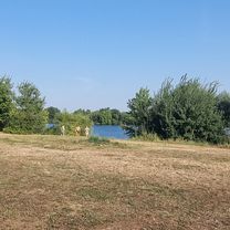
Overview
About this route
Miskolc vasútállomástól Egerig
Lillafüredtől az egri országúton Egerig. Lillafüred-Répáshuta között 12km-en keresztül emelkedik az út, de tolni nem feltétlenül kell a kerékpárt.
Az utat többféle verzióban is megtettem:
a) közvetlenül
b) a Szinva-forrás körüli szerpentinek után az erdőgazdasági úton Szilvásvárad felé kell eltérni, majd onnan Egerbe.
c) Eger felől kezdve Répáshuta előtt a Bükkfennsíkra vezető gépjárműforgalom elől elzárt úton Bánkútra, majd onnan Lillafüred és Miskolc.
- -:--
- Duration
- 65.2 km
- Distance
- 636 m
- Ascent
- 597 m
- Descent
- ---
- Avg. speed
- ---
- Max. altitude

Route quality
Waytypes & surfaces along the route
Waytypes
Busy road
34.3 km
(53 %)
Road
10.3 km
(16 %)
Surfaces
Paved
47.8 km
(73 %)
Asphalt
41.1 km
(63 %)
Paving stones
6.3 km
(10 %)
Continue with Bikemap
Use, edit, or download this cycling route
You would like to ride Miskolc-Eger or customize it for your own trip? Here is what you can do with this Bikemap route:
Free features
- Save this route as favorite or in collections
- Copy & plan your own version of this route
- Sync your route with Garmin or Wahoo
Premium features
Free trial for 3 days, or one-time payment. More about Bikemap Premium.
- Navigate this route on iOS & Android
- Export a GPX / KML file of this route
- Create your custom printout (try it for free)
- Download this route for offline navigation
Discover more Premium features.
Get Bikemap PremiumFrom our community
Other popular routes starting in Miskolc
 2018.05.05 Mc-Bükkaranyos-Nyékládháza-Ónod-Felsőzsolca-Mc
- Distance
- 66 km
- Ascent
- 190 m
- Descent
- 190 m
- Location
- Miskolc, Borsod-Abauj Zemplen county, Hungary
 Miskolc-Nyéki tó (István tó)
- Distance
- 45.7 km
- Ascent
- 172 m
- Descent
- 187 m
- Location
- Miskolc, Borsod-Abauj Zemplen county, Hungary
 Könyves-Hámori tó (északi oldalon)
- Distance
- 11.7 km
- Ascent
- 294 m
- Descent
- 142 m
- Location
- Miskolc, Borsod-Abauj Zemplen county, Hungary
 KME - Szirt túra I. 2016
- Distance
- 103.9 km
- Ascent
- 1,218 m
- Descent
- 1,213 m
- Location
- Miskolc, Borsod-Abauj Zemplen county, Hungary
 KME - Északi Bükk II. 2016
- Distance
- 55.9 km
- Ascent
- 729 m
- Descent
- 721 m
- Location
- Miskolc, Borsod-Abauj Zemplen county, Hungary
 Miskolctapolca-Kisgyőr az év kerékpárútja jelölt
- Distance
- 67.5 km
- Ascent
- 748 m
- Descent
- 750 m
- Location
- Miskolc, Borsod-Abauj Zemplen county, Hungary
 Miskolc - Lillafüred - Nagy-Mező - Olasz kapu - Szilvási kő - Bánkút - Felső-Borovnyák - Ómassa - Miskolc
- Distance
- 88.2 km
- Ascent
- 1,827 m
- Descent
- 1,827 m
- Location
- Miskolc, Borsod-Abauj Zemplen county, Hungary
 Miskolc - Lillafüred - Jávorkút - Nagy-mező- Bánkút - Bálvány hegy - Csipkéskút - Ómassa - Miskolc
- Distance
- 82.8 km
- Ascent
- 1,216 m
- Descent
- 1,215 m
- Location
- Miskolc, Borsod-Abauj Zemplen county, Hungary
Open it in the app