

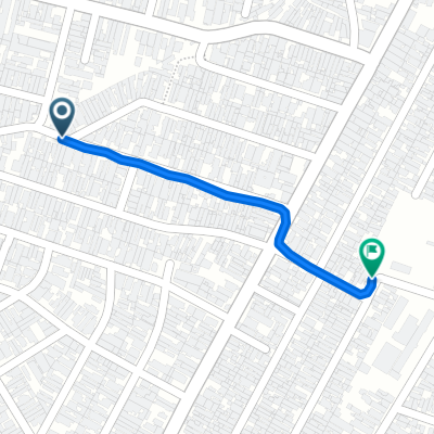
Av. Itaquera até João Mendes- Sé
A cycling route starting in São Caetano do Sul, São Paulo, Brazil.
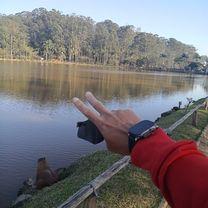
Overview
About this route
Guys, the way to go from the neighborhood to the center is easier. Taking the usual precautions, as it passes through some busy streets, like Mooca street. A little before there is a block that goes the wrong way. I prefer to go with A LOT OF CAUTION on the sidewalk, I take the opportunity to drink some water, it's a block from a park. The one in Mooca. At the end of the route, there is a nice uphill to work hard and test endurance. Since I'm arriving, I pedal to get there with my legs a bit tingling. Take the opportunity to grab a juice right in front of the taxi stand.
- -:--
- Duration
- 16.7 km
- Distance
- 133 m
- Ascent
- 129 m
- Descent
- ---
- Avg. speed
- ---
- Max. altitude
Route highlights
Points of interest along the route
Point of interest after 8.7 km
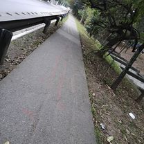
Aqui acaba a ciclovia uma opção é atravessar para a rua tuiuti do lado do shopping tatuapé. e seguiur pelo viaduto estaiado.
Point of interest after 11.8 km
Esta parte do trajeto de um grande quarteirão segue na contramão. Eu prefico ir com MUITO CUIDADO, e BEM DEVAGAR pela calçada, pois tem a aacd onde pessoas com dificuldade de locomoção andam com frequencia.
Continue with Bikemap
Use, edit, or download this cycling route
You would like to ride Av. Itaquera até João Mendes- Sé or customize it for your own trip? Here is what you can do with this Bikemap route:
Free features
- Save this route as favorite or in collections
- Copy & plan your own version of this route
- Sync your route with Garmin or Wahoo
Premium features
Free trial for 3 days, or one-time payment. More about Bikemap Premium.
- Navigate this route on iOS & Android
- Export a GPX / KML file of this route
- Create your custom printout (try it for free)
- Download this route for offline navigation
Discover more Premium features.
Get Bikemap PremiumFrom our community
Other popular routes starting in São Caetano do Sul
 De Rua Palmeira Bacaba 277 a Rua Alfavaca 81
- Distance
- 76.5 km
- Ascent
- 445 m
- Descent
- 495 m
- Location
- São Caetano do Sul, São Paulo, Brazil
 De Rua Doresópolis a Rua Doresópolis
- Distance
- 14 km
- Ascent
- 325 m
- Descent
- 329 m
- Location
- São Caetano do Sul, São Paulo, Brazil
 De Rua José Modesto de Godói a Avenida Varsóvia
- Distance
- 18 km
- Ascent
- 155 m
- Descent
- 175 m
- Location
- São Caetano do Sul, São Paulo, Brazil
 De Avenida Montemagno a Rua Rei Alberto da Bélgica
- Distance
- 0.8 km
- Ascent
- 45 m
- Descent
- 23 m
- Location
- São Caetano do Sul, São Paulo, Brazil
 Rua Barbinos, São Paulo a Rua Antônio Anunziato, São Paulo
- Distance
- 12.9 km
- Ascent
- 57 m
- Descent
- 51 m
- Location
- São Caetano do Sul, São Paulo, Brazil
 De Avenida Professor Edgar Santos a Avenida Professor Edgar Santos
- Distance
- 4 km
- Ascent
- 107 m
- Descent
- 120 m
- Location
- São Caetano do Sul, São Paulo, Brazil
 De Avenida Afonso de Sampaio e Sousa a Avenida Afonso de Sampaio e Sousa
- Distance
- 2.4 km
- Ascent
- 57 m
- Descent
- 27 m
- Location
- São Caetano do Sul, São Paulo, Brazil
 Loop São Caetano x São Bernardo
- Distance
- 32.3 km
- Ascent
- 191 m
- Descent
- 190 m
- Location
- São Caetano do Sul, São Paulo, Brazil
Open it in the app