

Zeppelin2010_islanda2013_lunga
A cycling route starting in Reykjavik, Capital Region, Iceland.
Overview
About this route
- -:--
- Duration
- 1,811.1 km
- Distance
- 4,042 m
- Ascent
- 4,053 m
- Descent
- ---
- Avg. speed
- ---
- Max. altitude

Route highlights
Points of interest along the route
Accommodation after 0.7 km
Reykiavik
Accommodation after 127.9 km
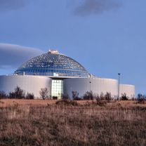
Geysir
Accommodation after 414.4 km
Akureyri
Accommodation after 510.7 km
Myvtan
Point of interest after 683.1 km
Husavik
Point of interest after 857.9 km
laghi Viti e Oskjuvatn
Accommodation after 1,084.4 km
Fljotsdalsheidi
Accommodation after 1,155.7 km
Djuivogur-
Point of interest after 1,335.5 km
Iceberg di Jokulsarlon
Accommodation after 1,467.7 km
Hvoll
Point of interest after 1,486.6 km
crateri del Laki
Accommodation after 1,572.7 km
Landmannalaugar
Accommodation after 1,647.4 km
Hvolsvollur
Point of interest after 1,668.6 km
Isole Vestmannaeyjar
Continue with Bikemap
Use, edit, or download this cycling route
You would like to ride Zeppelin2010_islanda2013_lunga or customize it for your own trip? Here is what you can do with this Bikemap route:
Free features
- Save this route as favorite or in collections
- Copy & plan your own version of this route
- Split it into stages to create a multi-day tour
- Sync your route with Garmin or Wahoo
Premium features
Free trial for 3 days, or one-time payment. More about Bikemap Premium.
- Navigate this route on iOS & Android
- Export a GPX / KML file of this route
- Create your custom printout (try it for free)
- Download this route for offline navigation
Discover more Premium features.
Get Bikemap PremiumFrom our community
Other popular routes starting in Reykjavik
 Along the ringroad
- Distance
- 1,476.8 km
- Ascent
- 0 m
- Descent
- 0 m
- Location
- Reykjavik, Capital Region, Iceland
 Zeppelin2010_islanda2013_lunga
- Distance
- 1,811.1 km
- Ascent
- 4,042 m
- Descent
- 4,053 m
- Location
- Reykjavik, Capital Region, Iceland
 Hraunbær, Reykjavík to Tröllakór, Kópavogur
- Distance
- 6.1 km
- Ascent
- 65 m
- Descent
- 33 m
- Location
- Reykjavik, Capital Region, Iceland
 Neblogai
- Distance
- 13.8 km
- Ascent
- 132 m
- Descent
- 74 m
- Location
- Reykjavik, Capital Region, Iceland
 Miklabraut 68, Reykjavík to Ránargata 30a, Reykjavík
- Distance
- 5 km
- Ascent
- 210 m
- Descent
- 238 m
- Location
- Reykjavik, Capital Region, Iceland
 Vatnsmýrarvegur, Reykjavík to Tröllakór, Kópavogur
- Distance
- 10.9 km
- Ascent
- 125 m
- Descent
- 44 m
- Location
- Reykjavik, Capital Region, Iceland
 Island day#1
- Distance
- 64.2 km
- Ascent
- 0 m
- Descent
- 0 m
- Location
- Reykjavik, Capital Region, Iceland
 Hjól í kringum höfuðborgarsvæðið
- Distance
- 68.7 km
- Ascent
- 271 m
- Descent
- 278 m
- Location
- Reykjavik, Capital Region, Iceland
Open it in the app