
Wetterau und Jugendstil
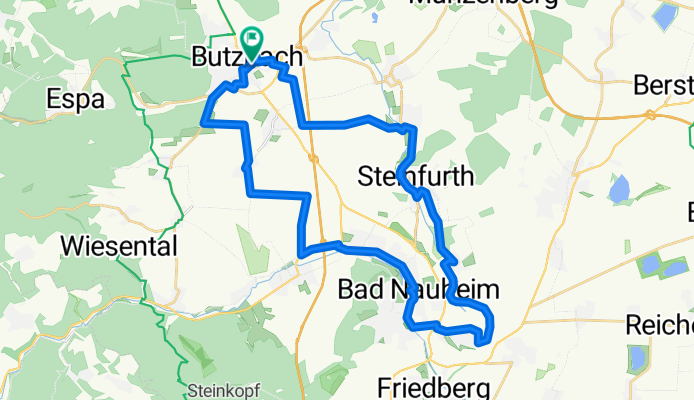
A cycling route starting in Butzbach, Hesse, Germany.
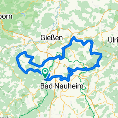
Overview
About this route
The route leads from Butzbach towards Hoch Weisel, passing the soldiers' cemetery in Ostheim. From Ostheim to Obermörlen, Niedermörlen, and Bad Nauheim. Through Bad Nauheim along the spa park until the last saltworks, here turning left towards Schwalheim. Further towards Dorheim, Wisselsheim, Steinfurt Oppershofen back to Ostheim, then back to Butzbach.
What to see:
Butzbach marketplace, Soldiers' Cemetery, Ostheim Fa. Müller cider production, Bad Nauheim - Art Nouveau spa facilities and spa park, waterwheel at Schwalheim with the longest connecting rod in Europe, Sauerbrunnen spring at Dorheim, Rosengarten and Rose Museum in Steinfurt.
Views of Winterstein, Frauenberg Wetterau, and Vogelsberg.
A nice route in the morning or afternoon. With sightseeing, the route can also be extended to a whole day. The Rose Museum is worth a visit. (a place to have coffee)
- -:--
- Duration
- 35.8 km
- Distance
- 131 m
- Ascent
- 137 m
- Descent
- ---
- Avg. speed
- ---
- Max. altitude

Route quality
Waytypes & surfaces along the route
Waytypes
Track
13.6 km
(38 %)
Quiet road
9.7 km
(27 %)
Surfaces
Paved
29.7 km
(83 %)
Unpaved
1.8 km
(5 %)
Asphalt
22.2 km
(62 %)
Paved (undefined)
5.4 km
(15 %)
Continue with Bikemap
Use, edit, or download this cycling route
You would like to ride Wetterau und Jugendstil or customize it for your own trip? Here is what you can do with this Bikemap route:
Free features
- Save this route as favorite or in collections
- Copy & plan your own version of this route
- Sync your route with Garmin or Wahoo
Premium features
Free trial for 3 days, or one-time payment. More about Bikemap Premium.
- Navigate this route on iOS & Android
- Export a GPX / KML file of this route
- Create your custom printout (try it for free)
- Download this route for offline navigation
Discover more Premium features.
Get Bikemap PremiumFrom our community
Other popular routes starting in Butzbach
 RTF RV Hoch-Weisel Tour 1
- Distance
- 154.8 km
- Ascent
- 902 m
- Descent
- 899 m
- Location
- Butzbach, Hesse, Germany
 151213 BBWT 26 km 470 HM
- Distance
- 26.3 km
- Ascent
- 545 m
- Descent
- 545 m
- Location
- Butzbach, Hesse, Germany
 CTF RV Hoch-Weisel Tour 4 mit 7UP's
- Distance
- 32.3 km
- Ascent
- 577 m
- Descent
- 577 m
- Location
- Butzbach, Hesse, Germany
 Limes und Münzenberg
- Distance
- 26 km
- Ascent
- 256 m
- Descent
- 259 m
- Location
- Butzbach, Hesse, Germany
 151213 BBWT 20-400
- Distance
- 20.6 km
- Ascent
- 419 m
- Descent
- 420 m
- Location
- Butzbach, Hesse, Germany
 151213 BBWT 16 km 300 HM
- Distance
- 16 km
- Ascent
- 333 m
- Descent
- 332 m
- Location
- Butzbach, Hesse, Germany
 RTF RV Hoch-Weisel Tour 3
- Distance
- 74.8 km
- Ascent
- 589 m
- Descent
- 586 m
- Location
- Butzbach, Hesse, Germany
 Butzbachs Osten
- Distance
- 24 km
- Ascent
- 145 m
- Descent
- 161 m
- Location
- Butzbach, Hesse, Germany
Open it in the app