

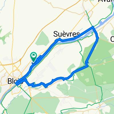
Loire völgye (Blois-Montbazon)
A cycling route starting in La Chaussée-Saint-Victor, Centre-Val de Loire, France.
Overview
About this route
- -:--
- Duration
- 88.7 km
- Distance
- 205 m
- Ascent
- 223 m
- Descent
- ---
- Avg. speed
- ---
- Max. altitude

Route quality
Waytypes & surfaces along the route
Waytypes
Road
34.6 km
(39 %)
Quiet road
20.4 km
(23 %)
Surfaces
Paved
22.2 km
(25 %)
Unpaved
5.3 km
(6 %)
Asphalt
21.3 km
(24 %)
Sand
2.7 km
(3 %)
Route highlights
Points of interest along the route
Point of interest after 4.8 km
Maison de la Magie
Point of interest after 4.9 km
Château de Blois
Point of interest after 24.7 km
Château de Chaumont-sur-Loire
Point of interest after 48.3 km
Chenonceau Castellum
Point of interest after 64.9 km
Château de Nitray
Point of interest after 87.9 km
Château de Montbazon
Point of interest after 88 km
Château d'Artigny
Continue with Bikemap
Use, edit, or download this cycling route
You would like to ride Loire völgye (Blois-Montbazon) or customize it for your own trip? Here is what you can do with this Bikemap route:
Free features
- Save this route as favorite or in collections
- Copy & plan your own version of this route
- Split it into stages to create a multi-day tour
- Sync your route with Garmin or Wahoo
Premium features
Free trial for 3 days, or one-time payment. More about Bikemap Premium.
- Navigate this route on iOS & Android
- Export a GPX / KML file of this route
- Create your custom printout (try it for free)
- Download this route for offline navigation
Discover more Premium features.
Get Bikemap PremiumFrom our community
Other popular routes starting in La Chaussée-Saint-Victor
 Day 38
- Distance
- 64 km
- Ascent
- 208 m
- Descent
- 185 m
- Location
- La Chaussée-Saint-Victor, Centre-Val de Loire, France
 Loire völgye (Blois-Orléans)
- Distance
- 64.6 km
- Ascent
- 136 m
- Descent
- 113 m
- Location
- La Chaussée-Saint-Victor, Centre-Val de Loire, France
 Day 10: Blois to Tours
- Distance
- 69.5 km
- Ascent
- 267 m
- Descent
- 288 m
- Location
- La Chaussée-Saint-Victor, Centre-Val de Loire, France
 5 Rue de la Borde, Saint-Denis-sur-Loire à 7 Rue du Vieux Moulin, Saint-Denis-sur-Loire
- Distance
- 51.3 km
- Ascent
- 270 m
- Descent
- 276 m
- Location
- La Chaussée-Saint-Victor, Centre-Val de Loire, France
 De 933 Rue des Gailletrous, La Chaussée-Saint-Victor à 109 Rue de la Garde, Mont-près-Chambord
- Distance
- 12.3 km
- Ascent
- 68 m
- Descent
- 91 m
- Location
- La Chaussée-Saint-Victor, Centre-Val de Loire, France
 Loire völgye (Blois-Montbazon)
- Distance
- 88.7 km
- Ascent
- 205 m
- Descent
- 223 m
- Location
- La Chaussée-Saint-Victor, Centre-Val de Loire, France
 GradoviLoare
- Distance
- 56.8 km
- Ascent
- 288 m
- Descent
- 290 m
- Location
- La Chaussée-Saint-Victor, Centre-Val de Loire, France
 Châteaux de la Loire
- Distance
- 165.3 km
- Ascent
- 573 m
- Descent
- 618 m
- Location
- La Chaussée-Saint-Victor, Centre-Val de Loire, France
Open it in the app