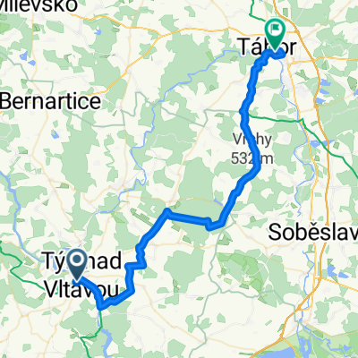
Freistadt - Berlin Etappe 4
A cycling route starting in Týn nad Vltavou, Jihočeský kraj, Czechia.
Overview
About this route
Tyn nad Vativou - Orlik nad Vativou 05.08.2008
- -:--
- Duration
- 77.8 km
- Distance
- 695 m
- Ascent
- 640 m
- Descent
- ---
- Avg. speed
- ---
- Avg. speed
Route quality
Waytypes & surfaces along the route
Waytypes
Busy road
31.6 km
(41 %)
Road
29.4 km
(38 %)
Surfaces
Paved
17.3 km
(22 %)
Unpaved
7.8 km
(10 %)
Asphalt
15.9 km
(20 %)
Gravel
4.3 km
(5 %)
Continue with Bikemap
Use, edit, or download this cycling route
You would like to ride Freistadt - Berlin Etappe 4 or customize it for your own trip? Here is what you can do with this Bikemap route:
Free features
- Save this route as favorite or in collections
- Copy & plan your own version of this route
- Sync your route with Garmin or Wahoo
Premium features
Free trial for 3 days, or one-time payment. More about Bikemap Premium.
- Navigate this route on iOS & Android
- Export a GPX / KML file of this route
- Create your custom printout (try it for free)
- Download this route for offline navigation
Discover more Premium features.
Get Bikemap PremiumFrom our community
Other popular routes starting in Týn nad Vltavou
- Den 2 (Veselí n. Lužnicí, Linz, Vídeň, UH)
- Distance
- 99.4 km
- Ascent
- 1,050 m
- Descent
- 714 m
- Location
- Týn nad Vltavou, Jihočeský kraj, Czechia
- Velká cena Temelína
- Distance
- 100.5 km
- Ascent
- 1,211 m
- Descent
- 1,086 m
- Location
- Týn nad Vltavou, Jihočeský kraj, Czechia
- Klasika Tyn-Hluboka-Tyn
- Distance
- 58.3 km
- Ascent
- 606 m
- Descent
- 607 m
- Location
- Týn nad Vltavou, Jihočeský kraj, Czechia
- IV. etapa OjČ 2014
- Distance
- 153.3 km
- Ascent
- 1,034 m
- Descent
- 921 m
- Location
- Týn nad Vltavou, Jihočeský kraj, Czechia
- Freistadt - Berlin Etappe 4
- Distance
- 77.8 km
- Ascent
- 695 m
- Descent
- 640 m
- Location
- Týn nad Vltavou, Jihočeský kraj, Czechia
- C03 Tyn-Krumlov
- Distance
- 68.1 km
- Ascent
- 545 m
- Descent
- 417 m
- Location
- Týn nad Vltavou, Jihočeský kraj, Czechia
- Tyn - Klucenice
- Distance
- 69.7 km
- Ascent
- 686 m
- Descent
- 571 m
- Location
- Týn nad Vltavou, Jihočeský kraj, Czechia
- Oparansky okruh
- Distance
- 60.2 km
- Ascent
- 414 m
- Descent
- 412 m
- Location
- Týn nad Vltavou, Jihočeský kraj, Czechia
Open it in the app