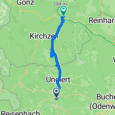
Mudau-Gaimühle-Sensbacher Höhe -Beerfelden -Wald-Michelbach
A cycling route starting in Mudau, Baden-Württemberg, Germany.
Overview
About this route
- -:--
- Duration
- 53.3 km
- Distance
- 655 m
- Ascent
- 779 m
- Descent
- ---
- Avg. speed
- ---
- Avg. speed
Route quality
Waytypes & surfaces along the route
Waytypes
Busy road
16.9 km
(32 %)
Quiet road
16 km
(30 %)
Surfaces
Paved
33.1 km
(62 %)
Unpaved
8.5 km
(16 %)
Asphalt
31.1 km
(58 %)
Gravel
8.3 km
(16 %)
Continue with Bikemap
Use, edit, or download this cycling route
You would like to ride Mudau-Gaimühle-Sensbacher Höhe -Beerfelden -Wald-Michelbach or customize it for your own trip? Here is what you can do with this Bikemap route:
Free features
- Save this route as favorite or in collections
- Copy & plan your own version of this route
- Sync your route with Garmin or Wahoo
Premium features
Free trial for 3 days, or one-time payment. More about Bikemap Premium.
- Navigate this route on iOS & Android
- Export a GPX / KML file of this route
- Create your custom printout (try it for free)
- Download this route for offline navigation
Discover more Premium features.
Get Bikemap PremiumFrom our community
Other popular routes starting in Mudau
- 20130808_Mudau nach Roßdorf
- Distance
- 139.1 km
- Ascent
- 668 m
- Descent
- 923 m
- Location
- Mudau, Baden-Württemberg, Germany
- Mudau-Gaimühle-Sensbacher Höhe -Beerfelden -Wald-Michelbach
- Distance
- 53.3 km
- Ascent
- 655 m
- Descent
- 779 m
- Location
- Mudau, Baden-Württemberg, Germany
- Limes- Niebelubgensteig
- Distance
- 36.6 km
- Ascent
- 1,044 m
- Descent
- 1,045 m
- Location
- Mudau, Baden-Württemberg, Germany
- Mudau-Steinbach-Beuchen-Mudau über St3
- Distance
- 17.8 km
- Ascent
- 231 m
- Descent
- 231 m
- Location
- Mudau, Baden-Württemberg, Germany
- Odenwald mit Höhen und Tiefen
- Distance
- 55.8 km
- Ascent
- 669 m
- Descent
- 669 m
- Location
- Mudau, Baden-Württemberg, Germany
- mudau-mosbach
- Distance
- 29.4 km
- Ascent
- 287 m
- Descent
- 578 m
- Location
- Mudau, Baden-Württemberg, Germany
- Rund um Mudau
- Distance
- 41.9 km
- Ascent
- 438 m
- Descent
- 436 m
- Location
- Mudau, Baden-Württemberg, Germany
- Odenwald - 4 Tage mit E-Bike und Zelt - Tag 1 - Oberscheidtal bis Klingenberg
- Distance
- 39.9 km
- Ascent
- 207 m
- Descent
- 605 m
- Location
- Mudau, Baden-Württemberg, Germany
Open it in the app