

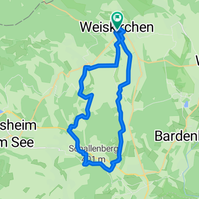
Von Weiskirchen zur Dellborner Mühle
A cycling route starting in Weiskirchen, Saarland, Germany.
Overview
About this route
The path mainly runs along paved agricultural routes but also on well-passable forest paths. Suitable for touring bikes and mountain bikes. At the Dellborner Mill (here as the endpoint of Niederlosheimer Str.), there is a guesthouse with a petting zoo, in Münchweiler the castle with a café, and in Weierweiler at School Kättchen you can stop by and at all three locations you can also sit outside when the weather is nice.
- -:--
- Duration
- 20.6 km
- Distance
- 252 m
- Ascent
- 311 m
- Descent
- ---
- Avg. speed
- 382 m
- Max. altitude
Route quality
Waytypes & surfaces along the route
Waytypes
Track
8 km
(39 %)
Access road
5.8 km
(28 %)
Surfaces
Paved
15.5 km
(75 %)
Unpaved
4.5 km
(22 %)
Asphalt
10.3 km
(50 %)
Paved (undefined)
5.2 km
(25 %)
Continue with Bikemap
Use, edit, or download this cycling route
You would like to ride Von Weiskirchen zur Dellborner Mühle or customize it for your own trip? Here is what you can do with this Bikemap route:
Free features
- Save this route as favorite or in collections
- Copy & plan your own version of this route
- Sync your route with Garmin or Wahoo
Premium features
Free trial for 3 days, or one-time payment. More about Bikemap Premium.
- Navigate this route on iOS & Android
- Export a GPX / KML file of this route
- Create your custom printout (try it for free)
- Download this route for offline navigation
Discover more Premium features.
Get Bikemap PremiumFrom our community
Other popular routes starting in Weiskirchen
 Saar Hunsrück 2 Waldhölzbach Börfink
- Distance
- 61.3 km
- Ascent
- 1,195 m
- Descent
- 1,142 m
- Location
- Weiskirchen, Saarland, Germany
 gebauer
- Distance
- 20.3 km
- Ascent
- 415 m
- Descent
- 419 m
- Location
- Weiskirchen, Saarland, Germany
 Von Weiskirchen zur Dellborner Mühle
- Distance
- 20.6 km
- Ascent
- 252 m
- Descent
- 311 m
- Location
- Weiskirchen, Saarland, Germany
 Zwei-Täler-Weg
- Distance
- 12.7 km
- Ascent
- 373 m
- Descent
- 372 m
- Location
- Weiskirchen, Saarland, Germany
 Traumschleife Felsenweg
- Distance
- 14.5 km
- Ascent
- 356 m
- Descent
- 362 m
- Location
- Weiskirchen, Saarland, Germany
 Saarlandradweg Etappe 2 25.5.18
- Distance
- 85.3 km
- Ascent
- 776 m
- Descent
- 784 m
- Location
- Weiskirchen, Saarland, Germany
 Weiskirchen - Bierfeld - Weiskirchen
- Distance
- 29.5 km
- Ascent
- 460 m
- Descent
- 460 m
- Location
- Weiskirchen, Saarland, Germany
 Von Weiskirchen über den Hochwald zum Losheimer See
- Distance
- 35.2 km
- Ascent
- 439 m
- Descent
- 495 m
- Location
- Weiskirchen, Saarland, Germany
Open it in the app