

Exelberg Runde CLONED FROM ROUTE 1674275
A cycling route starting in Stetten, Lower Austria, Austria.
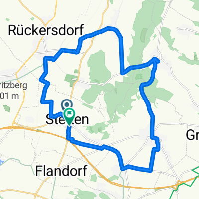
Overview
About this route
Der Streckenteil Gürtel bis Dornbach zählt sicher nicht zu den tollsten, aber es lohnt sich. Der Exelberganstieg und die Abfahrt über die Dopplerhütte sind dafür ein echter Hit.
- -:--
- Duration
- 70.7 km
- Distance
- 465 m
- Ascent
- 466 m
- Descent
- ---
- Avg. speed
- ---
- Max. altitude

Route quality
Waytypes & surfaces along the route
Waytypes
Busy road
30.8 km
(44 %)
Cycleway
21.9 km
(31 %)
Surfaces
Paved
61.8 km
(87 %)
Unpaved
0.7 km
(1 %)
Asphalt
59.1 km
(84 %)
Concrete
2.2 km
(3 %)
Continue with Bikemap
Use, edit, or download this cycling route
You would like to ride Exelberg Runde CLONED FROM ROUTE 1674275 or customize it for your own trip? Here is what you can do with this Bikemap route:
Free features
- Save this route as favorite or in collections
- Copy & plan your own version of this route
- Sync your route with Garmin or Wahoo
Premium features
Free trial for 3 days, or one-time payment. More about Bikemap Premium.
- Navigate this route on iOS & Android
- Export a GPX / KML file of this route
- Create your custom printout (try it for free)
- Download this route for offline navigation
Discover more Premium features.
Get Bikemap PremiumFrom our community
Other popular routes starting in Stetten
 highmaster highway
- Distance
- 65.7 km
- Ascent
- 267 m
- Descent
- 268 m
- Location
- Stetten, Lower Austria, Austria
 Stetten Experiment
- Distance
- 26.6 km
- Ascent
- 125 m
- Descent
- 128 m
- Location
- Stetten, Lower Austria, Austria
 Route zu Pfarre Stetten
- Distance
- 19.9 km
- Ascent
- 239 m
- Descent
- 240 m
- Location
- Stetten, Lower Austria, Austria
 Weinviertel-Donau-Radtour
- Distance
- 39.1 km
- Ascent
- 156 m
- Descent
- 157 m
- Location
- Stetten, Lower Austria, Austria
 Exelberg Runde
- Distance
- 70.9 km
- Ascent
- 465 m
- Descent
- 466 m
- Location
- Stetten, Lower Austria, Austria
 Stetten
- Distance
- 13.1 km
- Ascent
- 50 m
- Descent
- 62 m
- Location
- Stetten, Lower Austria, Austria
 Kreuttaler Wald 1
- Distance
- 22.3 km
- Ascent
- 433 m
- Descent
- 496 m
- Location
- Stetten, Lower Austria, Austria
 Stetten-Sierndorf-Ernstbrunn-Stetten
- Distance
- 64.8 km
- Ascent
- 200 m
- Descent
- 124 m
- Location
- Stetten, Lower Austria, Austria
Open it in the app