

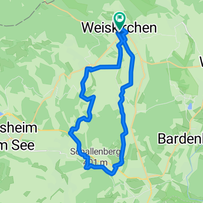
Von Weiskirchen über den Hochwald zum Losheimer See
A cycling route starting in Weiskirchen, Saarland, Germany.
Overview
About this route
Beautiful not too demanding afternoon tour for touring bikes or mountain bikes. From Weiskirchen, past the spa clinics, you head onto the ridge of the Hochwald. From there, it’s downhill to Greimerath. Through the forest, then to Bergen, where you have to climb a bit again. The highlight is the Losheim reservoir where you can enjoy a nice meal in the brewery. In Losheim, you also pass by the museum train and then return to Weiskirchen via Weierweiler.
- -:--
- Duration
- 35.2 km
- Distance
- 439 m
- Ascent
- 495 m
- Descent
- ---
- Avg. speed
- 608 m
- Max. altitude
Route quality
Waytypes & surfaces along the route
Waytypes
Track
15.5 km
(44 %)
Quiet road
7.4 km
(21 %)
Surfaces
Paved
22.2 km
(63 %)
Unpaved
13 km
(37 %)
Asphalt
18.3 km
(52 %)
Gravel
11.6 km
(33 %)
Continue with Bikemap
Use, edit, or download this cycling route
You would like to ride Von Weiskirchen über den Hochwald zum Losheimer See or customize it for your own trip? Here is what you can do with this Bikemap route:
Free features
- Save this route as favorite or in collections
- Copy & plan your own version of this route
- Sync your route with Garmin or Wahoo
Premium features
Free trial for 3 days, or one-time payment. More about Bikemap Premium.
- Navigate this route on iOS & Android
- Export a GPX / KML file of this route
- Create your custom printout (try it for free)
- Download this route for offline navigation
Discover more Premium features.
Get Bikemap PremiumFrom our community
Other popular routes starting in Weiskirchen
 Von Weiskirchen über den Hochwald zum Losheimer See
- Distance
- 35.2 km
- Ascent
- 439 m
- Descent
- 495 m
- Location
- Weiskirchen, Saarland, Germany
 Weierweiler-Geisweilersee-Nunkirchen-Weierweiler
- Distance
- 24.1 km
- Ascent
- 269 m
- Descent
- 270 m
- Location
- Weiskirchen, Saarland, Germany
 Erlebnistour– Das abwechslungsreiche Radvergnügen
- Distance
- 21.7 km
- Ascent
- 272 m
- Descent
- 274 m
- Location
- Weiskirchen, Saarland, Germany
 gebauer
- Distance
- 20.3 km
- Ascent
- 415 m
- Descent
- 419 m
- Location
- Weiskirchen, Saarland, Germany
 Weiskirchen - Bierfeld - Weiskirchen
- Distance
- 29.5 km
- Ascent
- 460 m
- Descent
- 460 m
- Location
- Weiskirchen, Saarland, Germany
 Zwei-Täler-Weg
- Distance
- 12.7 km
- Ascent
- 373 m
- Descent
- 372 m
- Location
- Weiskirchen, Saarland, Germany
 Saarlandradweg Etappe 2 25.5.18
- Distance
- 85.3 km
- Ascent
- 776 m
- Descent
- 784 m
- Location
- Weiskirchen, Saarland, Germany
 Von Weiskirchen zur Dellborner Mühle
- Distance
- 20.6 km
- Ascent
- 252 m
- Descent
- 311 m
- Location
- Weiskirchen, Saarland, Germany
Open it in the app