

Aschau im Chiemgau - Rosenheim
A cycling route starting in Aschau im Chiemgau, Bavaria, Germany.
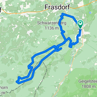
Overview
About this route
Diese Route ist ein idealer Weg zwischen Aschau im Chiemgau und Rosenheim. Er führt zu 98% auf geteerten Radwegen und 500m auf einem Schotterweg. Zwischen Aschau und Rohrdorf läuft er gemeinsam mit dem Bodesee-Königseeradweg. Für mich ist es die tägliche Trainingsstrecke auf dem Weg zur Arbeit. Mittelerweile seit 2002 mit gefahrenen 44.000km. (zwischen Frasdorf und Rohrdorf 10km Gefälle 200Höhenmeter)
- -:--
- Duration
- 25.2 km
- Distance
- 95 m
- Ascent
- 271 m
- Descent
- ---
- Avg. speed
- 643 m
- Max. altitude

Route quality
Waytypes & surfaces along the route
Waytypes
Path
13.6 km
(54 %)
Quiet road
4.3 km
(17 %)
Surfaces
Paved
23.2 km
(92 %)
Unpaved
1.5 km
(6 %)
Asphalt
22.9 km
(91 %)
Unpaved (undefined)
1.3 km
(5 %)
Continue with Bikemap
Use, edit, or download this cycling route
You would like to ride Aschau im Chiemgau - Rosenheim or customize it for your own trip? Here is what you can do with this Bikemap route:
Free features
- Save this route as favorite or in collections
- Copy & plan your own version of this route
- Sync your route with Garmin or Wahoo
Premium features
Free trial for 3 days, or one-time payment. More about Bikemap Premium.
- Navigate this route on iOS & Android
- Export a GPX / KML file of this route
- Create your custom printout (try it for free)
- Download this route for offline navigation
Discover more Premium features.
Get Bikemap PremiumFrom our community
Other popular routes starting in Aschau im Chiemgau
 Aschau-Wössnersee-Runde
- Distance
- 53.1 km
- Ascent
- 295 m
- Descent
- 303 m
- Location
- Aschau im Chiemgau, Bavaria, Germany
 Kampenwand
- Distance
- 8 km
- Ascent
- 884 m
- Descent
- 77 m
- Location
- Aschau im Chiemgau, Bavaria, Germany
 Hochries Umrundung
- Distance
- 36.1 km
- Ascent
- 1,229 m
- Descent
- 1,229 m
- Location
- Aschau im Chiemgau, Bavaria, Germany
 Kampenwand
- Distance
- 16.9 km
- Ascent
- 969 m
- Descent
- 970 m
- Location
- Aschau im Chiemgau, Bavaria, Germany
 aschau loop
- Distance
- 14.8 km
- Ascent
- 495 m
- Descent
- 490 m
- Location
- Aschau im Chiemgau, Bavaria, Germany
 Chiemgau: Frasdorf-Hochries
- Distance
- 34.9 km
- Ascent
- 1,180 m
- Descent
- 1,180 m
- Location
- Aschau im Chiemgau, Bavaria, Germany
 Sudelfeldpass
- Distance
- 98.3 km
- Ascent
- 1,405 m
- Descent
- 1,405 m
- Location
- Aschau im Chiemgau, Bavaria, Germany
 Transalp 2018
- Distance
- 500.6 km
- Ascent
- 5,688 m
- Descent
- 6,242 m
- Location
- Aschau im Chiemgau, Bavaria, Germany
Open it in the app