Mooloolaba - Rosemount - Tower Mtn - Ilkley Loop
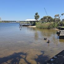
A cycling route starting in Mooloolabah, Queensland, Australia.
Overview
About this route
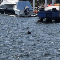
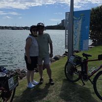
Start and Stop at Cafe Velo.
Includes approx 500m of Gravel on Paynters Creek Road.
- -:--
- Duration
- 56.6 km
- Distance
- 432 m
- Ascent
- 432 m
- Descent
- ---
- Avg. speed
- ---
- Max. altitude
Route quality
Waytypes & surfaces along the route
Waytypes
Quiet road
19.3 km
(34 %)
Road
16.4 km
(29 %)
Surfaces
Paved
52.1 km
(92 %)
Asphalt
34.6 km
(61 %)
Paved (undefined)
15.9 km
(28 %)
Route highlights
Points of interest along the route
Point of interest after 15.3 km
Gravel sector
Point of interest after 15.6 km
Gravel Sector
Continue with Bikemap
Use, edit, or download this cycling route
You would like to ride Mooloolaba - Rosemount - Tower Mtn - Ilkley Loop or customize it for your own trip? Here is what you can do with this Bikemap route:
Free features
- Save this route as favorite or in collections
- Copy & plan your own version of this route
- Sync your route with Garmin or Wahoo
Premium features
Free trial for 3 days, or one-time payment. More about Bikemap Premium.
- Navigate this route on iOS & Android
- Export a GPX / KML file of this route
- Create your custom printout (try it for free)
- Download this route for offline navigation
Discover more Premium features.
Get Bikemap PremiumFrom our community
Other popular routes starting in Mooloolabah
- Pursue Training Camp Ride 1 2017
- Distance
- 72 km
- Ascent
- 690 m
- Descent
- 690 m
- Location
- Mooloolabah, Queensland, Australia
- Sunshine Coast Scenic Cycle Loop: Moffat Beach, Point Cartwright & Mooloola River Canals
- Distance
- 40.4 km
- Ascent
- 81 m
- Descent
- 127 m
- Location
- Mooloolabah, Queensland, Australia
- Mooloolaba, Mooloolah River, Pt Cartwright Circuit
- Distance
- 27.4 km
- Ascent
- 66 m
- Descent
- 66 m
- Location
- Mooloolabah, Queensland, Australia
- Mooloolaba to Melany
- Distance
- 39.1 km
- Ascent
- 590 m
- Descent
- 150 m
- Location
- Mooloolabah, Queensland, Australia
- Pacific Boulevard 29, Buddina to Pacific Boulevard 29, Buddina
- Distance
- 26.3 km
- Ascent
- 199 m
- Descent
- 202 m
- Location
- Mooloolabah, Queensland, Australia
- La Balsa Park, Mooloolah R., Kawana Lake, Moffat Beach, return Coastal Path
- Distance
- 39.4 km
- Ascent
- 87 m
- Descent
- 88 m
- Location
- Mooloolabah, Queensland, Australia
- ThinkChange Pt Cartwright to Bokarina
- Distance
- 16.5 km
- Ascent
- 55 m
- Descent
- 57 m
- Location
- Mooloolabah, Queensland, Australia
- River to River, e-Bike Tour
- Distance
- 15.8 km
- Ascent
- 72 m
- Descent
- 74 m
- Location
- Mooloolabah, Queensland, Australia
Open it in the app