

Advanced Stage 1
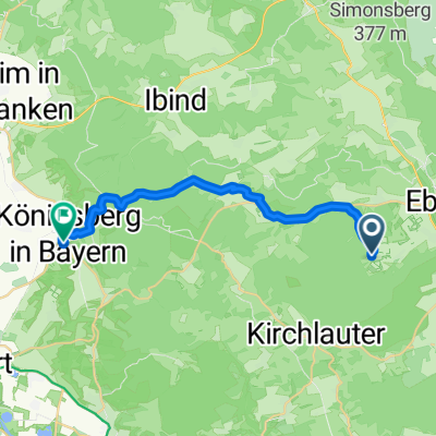
A cycling route starting in Rentweinsdorf, Bavaria, Germany.
Overview
About this route
Je mehr du hier schreibst, desto hilfreicher ist es für andere User.* Verlauf der Strecke.* Warum gefällt dir diese Route?* Warum empfiehlst du sie?* Was sind die Highlights?* usw.
- -:--
- Duration
- 66 km
- Distance
- 844 m
- Ascent
- 816 m
- Descent
- ---
- Avg. speed
- 426 m
- Max. altitude
Route quality
Waytypes & surfaces along the route
Waytypes
Road
43.7 km
(66 %)
Busy road
8.9 km
(13 %)
Surfaces
Paved
30.8 km
(47 %)
Unpaved
1.9 km
(3 %)
Asphalt
29.9 km
(45 %)
Gravel
1.8 km
(3 %)
Continue with Bikemap
Use, edit, or download this cycling route
You would like to ride Advanced Stage 1 or customize it for your own trip? Here is what you can do with this Bikemap route:
Free features
- Save this route as favorite or in collections
- Copy & plan your own version of this route
- Sync your route with Garmin or Wahoo
Premium features
Free trial for 3 days, or one-time payment. More about Bikemap Premium.
- Navigate this route on iOS & Android
- Export a GPX / KML file of this route
- Create your custom printout (try it for free)
- Download this route for offline navigation
Discover more Premium features.
Get Bikemap PremiumFrom our community
Other popular routes starting in Rentweinsdorf
 2-Tagestour übers Fichtelgebirge nach Tschechien
- Distance
- 238.1 km
- Ascent
- 1,787 m
- Descent
- 1,453 m
- Location
- Rentweinsdorf, Bavaria, Germany
 Eyrichshof - Bayreuth
- Distance
- 88.6 km
- Ascent
- 383 m
- Descent
- 313 m
- Location
- Rentweinsdorf, Bavaria, Germany
 Königsberg
- Distance
- 19.1 km
- Ascent
- 276 m
- Descent
- 316 m
- Location
- Rentweinsdorf, Bavaria, Germany
 Advanced Stage 1
- Distance
- 66 km
- Ascent
- 844 m
- Descent
- 816 m
- Location
- Rentweinsdorf, Bavaria, Germany
 Ebern, Ruinen Raueneck und Bramberg
- Distance
- 18.9 km
- Ascent
- 483 m
- Descent
- 255 m
- Location
- Rentweinsdorf, Bavaria, Germany
 In den wilden Osten
- Distance
- 102 km
- Ascent
- 1,067 m
- Descent
- 1,068 m
- Location
- Rentweinsdorf, Bavaria, Germany
 Testroute
- Distance
- 103.9 km
- Ascent
- 1,340 m
- Descent
- 1,290 m
- Location
- Rentweinsdorf, Bavaria, Germany
 Rundfahrt
- Distance
- 49.9 km
- Ascent
- 338 m
- Descent
- 341 m
- Location
- Rentweinsdorf, Bavaria, Germany
Open it in the app