tres puentes
- 4.7 km
- 49 m
- 39 m
- Cuenca, Azuay, Ecuador
A cycling route starting in Cuenca, Azuay, Ecuador.
Overview
created this 12 years ago
Route quality
Quiet road
7.2 km
(56 %)
Path
2.3 km
(18 %)
Paved
1.7 km
(13 %)
Unpaved
9.3 km
(72 %)
Unpaved (undefined)
8 km
(62 %)
Ground
1.2 km
(9 %)
Route highlights
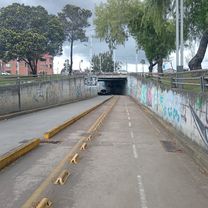
LAS CRUCES
Continue with Bikemap
You would like to ride RIO AMARILLO - LAS CRUCES - PICUDO or customize it for your own trip? Here is what you can do with this Bikemap route:
Free trial for 3 days, or one-time payment. More about Bikemap Premium.
Discover more Premium features.
Get Bikemap PremiumFrom our community
Open it in the app