

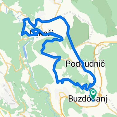
50.Orehovica-Podrvanj-Zastenice-Podhum-Dražice-Lukeži-Valići-Pašac-Orehovica
A cycling route starting in Čavle, Primorje-Gorski Kotar County, Croatia.
Overview
About this route
Sam početak treba gurati bicikl jedno 100mNakon toga mali uspon od 300m kasnije sve lagano.
- -:--
- Duration
- 20.6 km
- Distance
- 377 m
- Ascent
- 377 m
- Descent
- ---
- Avg. speed
- ---
- Max. altitude

Route highlights
Points of interest along the route

Photo after 1.6 km

Photo after 16.5 km

Photo after 16.7 km
Continue with Bikemap
Use, edit, or download this cycling route
You would like to ride 50.Orehovica-Podrvanj-Zastenice-Podhum-Dražice-Lukeži-Valići-Pašac-Orehovica or customize it for your own trip? Here is what you can do with this Bikemap route:
Free features
- Save this route as favorite or in collections
- Copy & plan your own version of this route
- Sync your route with Garmin or Wahoo
Premium features
Free trial for 3 days, or one-time payment. More about Bikemap Premium.
- Navigate this route on iOS & Android
- Export a GPX / KML file of this route
- Create your custom printout (try it for free)
- Download this route for offline navigation
Discover more Premium features.
Get Bikemap PremiumFrom our community
Other popular routes starting in Čavle
 Podčudnič to D3 57, Čavle
- Distance
- 38 km
- Ascent
- 461 m
- Descent
- 473 m
- Location
- Čavle, Primorje-Gorski Kotar County, Croatia
 Orehovica-Podrvanj-Zastenice-Podhum-Dražice-Lukeži-Valići-Pašac-Orehovica (GPS)
- Distance
- 20.7 km
- Ascent
- 399 m
- Descent
- 399 m
- Location
- Čavle, Primorje-Gorski Kotar County, Croatia
 Grobnik - nova
- Distance
- 22.1 km
- Ascent
- 362 m
- Descent
- 362 m
- Location
- Čavle, Primorje-Gorski Kotar County, Croatia
 put na triglav
- Distance
- 200.6 km
- Ascent
- 2,102 m
- Descent
- 1,876 m
- Location
- Čavle, Primorje-Gorski Kotar County, Croatia
 XC Maraton Grobnik-Lisac 2012 - natjecateljski dio
- Distance
- 38.7 km
- Ascent
- 1,023 m
- Descent
- 620 m
- Location
- Čavle, Primorje-Gorski Kotar County, Croatia
 Vožnjica
- Distance
- 31.2 km
- Ascent
- 451 m
- Descent
- 460 m
- Location
- Čavle, Primorje-Gorski Kotar County, Croatia
 Grobnik 2016 - obiteljska
- Distance
- 20.7 km
- Ascent
- 155 m
- Descent
- 155 m
- Location
- Čavle, Primorje-Gorski Kotar County, Croatia
 50.Orehovica-Podrvanj-Zastenice-Podhum-Dražice-Lukeži-Valići-Pašac-Orehovica
- Distance
- 20.6 km
- Ascent
- 377 m
- Descent
- 377 m
- Location
- Čavle, Primorje-Gorski Kotar County, Croatia
Open it in the app