

Rundkurs um die Waldgaststätte Emmrichshütte
A cycling route starting in Dichtelbach, Rhineland-Palatinate, Germany.
Overview
About this route
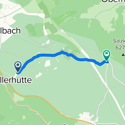
Brief explanation of the route: Start and finish are at the Wadlgaststätte Emmrichshütte. Upon arrival at the Emmrichshütte, a hearty meal awaits.
There were a few short climbs, followed by a longer, fast descent, and then the really long climb up to the wind turbines on the Kandrich. From the Kandrich, the route continues fairly flat to the Salzkopf. There are then two short trails heading towards the Franzosenkopf. With that, the toughest elevation gain was done. From here, the route is mostly downhill, though there are still a few more meters of climbing later on. On the wide forest road downhill you can pick up good speed, and likewise on the asphalt road by the meadows at the 'Hirtenborn'. The route should be doable in about 3 hours.
Note: The paths are mostly easily rideable. Still, keep your eyes open!
- -:--
- Duration
- 31.3 km
- Distance
- 562 m
- Ascent
- 562 m
- Descent
- ---
- Avg. speed
- ---
- Max. altitude

Route quality
Waytypes & surfaces along the route
Waytypes
Track
29.1 km
(93 %)
Quiet road
0.9 km
(3 %)
Surfaces
Paved
7.2 km
(23 %)
Unpaved
22.8 km
(73 %)
Gravel
17.2 km
(55 %)
Paved (undefined)
4.7 km
(15 %)
Route highlights
Points of interest along the route
Point of interest after 31.3 km
Start und Ziel ist die Waldgaststätte Emmrichshütte. www.waldgaststaette-emmerichshuette.de
Continue with Bikemap
Use, edit, or download this cycling route
You would like to ride Rundkurs um die Waldgaststätte Emmrichshütte or customize it for your own trip? Here is what you can do with this Bikemap route:
Free features
- Save this route as favorite or in collections
- Copy & plan your own version of this route
- Sync your route with Garmin or Wahoo
Premium features
Free trial for 3 days, or one-time payment. More about Bikemap Premium.
- Navigate this route on iOS & Android
- Export a GPX / KML file of this route
- Create your custom printout (try it for free)
- Download this route for offline navigation
Discover more Premium features.
Get Bikemap PremiumFrom our community
Other popular routes starting in Dichtelbach
 Teves Straße, Daxweiler nach Hinterster Graben 10, Rheinböllen
- Distance
- 4.5 km
- Ascent
- 78 m
- Descent
- 65 m
- Location
- Dichtelbach, Rhineland-Palatinate, Germany
 Rundkurs um die Waldgaststätte Emmrichshütte
- Distance
- 31.3 km
- Ascent
- 562 m
- Descent
- 562 m
- Location
- Dichtelbach, Rhineland-Palatinate, Germany
 Niederwald
- Distance
- 31.9 km
- Ascent
- 455 m
- Descent
- 551 m
- Location
- Dichtelbach, Rhineland-Palatinate, Germany
 Ditchelbacher Rad-MTB Kurzstrecke 2008
- Distance
- 35.4 km
- Ascent
- 658 m
- Descent
- 660 m
- Location
- Dichtelbach, Rhineland-Palatinate, Germany
 Kandrich & Ohligsberg / Emmerichshütte
- Distance
- 9.8 km
- Ascent
- 221 m
- Descent
- 221 m
- Location
- Dichtelbach, Rhineland-Palatinate, Germany
 Emmerichshütte 1, Daxweiler nach Forsthaus Lauschhütte 0, Weiler bei Bingen
- Distance
- 5.1 km
- Ascent
- 160 m
- Descent
- 92 m
- Location
- Dichtelbach, Rhineland-Palatinate, Germany
 059 a Araltankstelle Rheinböllen - Pfalzfeld - Emmelshausen - Brodenbach - Burgen - Beltheim - Laubach - Araltankstelle Rheinböllen
- Distance
- 89.1 km
- Ascent
- 971 m
- Descent
- 972 m
- Location
- Dichtelbach, Rhineland-Palatinate, Germany
 059 b Araltankstelle Rheinböllen - Pfalzfeld - Emmelshausen - Beltheim - Laubach - Araltankstelle Rheinböllen
- Distance
- 62.7 km
- Ascent
- 655 m
- Descent
- 653 m
- Location
- Dichtelbach, Rhineland-Palatinate, Germany
Open it in the app