
Nice route to Passo Manghen (2000m)
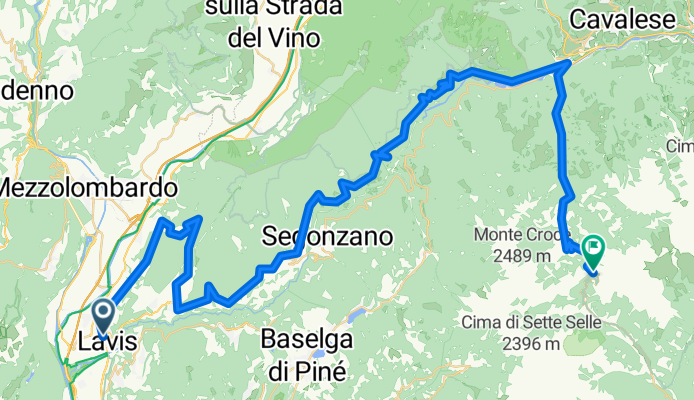
A cycling route starting in Lavis, Trentino-Alto Adige, Italy.
Overview
About this route
This is a nice route upto the Passo Manghen. It has been specially selected to avoid roads with car traffic. In the first part you cycle through panoramic secondary roads in an area where wine is produced. During the week you may encounter tracks from Ceola to Capriana. The climb from Molina di Fiemme to Passo Manghen is still during the week and busy on Sunday, specially with motocyclists. I did it once in spring when the pass was still close to cars and motocycle for the winter. The road was clean and I was alone up to the top.
- -:--
- Duration
- 71.9 km
- Distance
- 3,056 m
- Ascent
- 1,953 m
- Descent
- ---
- Avg. speed
- 1,327 m
- Max. altitude
Route quality
Waytypes & surfaces along the route
Waytypes
Road
21.6 km
(30 %)
Quiet road
6.5 km
(9 %)
Surfaces
Paved
43.1 km
(60 %)
Asphalt
42.4 km
(59 %)
Paved (undefined)
0.7 km
(1 %)
Undefined
28.7 km
(40 %)
Continue with Bikemap
Use, edit, or download this cycling route
You would like to ride Nice route to Passo Manghen (2000m) or customize it for your own trip? Here is what you can do with this Bikemap route:
Free features
- Save this route as favorite or in collections
- Copy & plan your own version of this route
- Sync your route with Garmin or Wahoo
Premium features
Free trial for 3 days, or one-time payment. More about Bikemap Premium.
- Navigate this route on iOS & Android
- Export a GPX / KML file of this route
- Create your custom printout (try it for free)
- Download this route for offline navigation
Discover more Premium features.
Get Bikemap PremiumFrom our community
Other popular routes starting in Lavis
 Dolomite West - East (Trento - Carnia)
- Distance
- 352.1 km
- Ascent
- 5,474 m
- Descent
- 5,424 m
- Location
- Lavis, Trentino-Alto Adige, Italy
 Lavis - Bezzecca
- Distance
- 76.5 km
- Ascent
- 783 m
- Descent
- 279 m
- Location
- Lavis, Trentino-Alto Adige, Italy
 Alpen15-6
- Distance
- 75.8 km
- Ascent
- 1,575 m
- Descent
- 1,724 m
- Location
- Lavis, Trentino-Alto Adige, Italy
 Gerade Fahrt in
- Distance
- 93.7 km
- Ascent
- 1,807 m
- Descent
- 993 m
- Location
- Lavis, Trentino-Alto Adige, Italy
 1te Tag "Trentino-Belluno
- Distance
- 59.8 km
- Ascent
- 1,076 m
- Descent
- 1,050 m
- Location
- Lavis, Trentino-Alto Adige, Italy
 TRENTO - CICLABILE VALSUGANA RACCORDO
- Distance
- 35.6 km
- Ascent
- 417 m
- Descent
- 213 m
- Location
- Lavis, Trentino-Alto Adige, Italy
 Runde ins Feimstal (Trentino)
- Distance
- 85.1 km
- Ascent
- 3,564 m
- Descent
- 3,563 m
- Location
- Lavis, Trentino-Alto Adige, Italy
 5. Etappe Laris nach Rovereto
- Distance
- 36.6 km
- Ascent
- 50 m
- Descent
- 84 m
- Location
- Lavis, Trentino-Alto Adige, Italy
Open it in the app