Montes UPA Almaden Melonares
A cycling route starting in Cantillana, Andalusia, Spain.
Overview
About this route
Etapón por la Sierra Norte de Sevilla.
Preparatoria para La Capitana 2013.
- -:--
- Duration
- 81.9 km
- Distance
- 1,035 m
- Ascent
- 1,035 m
- Descent
- ---
- Avg. speed
- ---
- Avg. speed
Route quality
Waytypes & surfaces along the route
Waytypes
Track
42.8 km
(52 %)
Road
19.6 km
(24 %)
Surfaces
Paved
4.7 km
(6 %)
Unpaved
42.4 km
(52 %)
Gravel
42.4 km
(52 %)
Paved (undefined)
4.7 km
(6 %)
Undefined
34.8 km
(42 %)
Continue with Bikemap
Use, edit, or download this cycling route
You would like to ride Montes UPA Almaden Melonares or customize it for your own trip? Here is what you can do with this Bikemap route:
Free features
- Save this route as favorite or in collections
- Copy & plan your own version of this route
- Sync your route with Garmin or Wahoo
Premium features
Free trial for 3 days, or one-time payment. More about Bikemap Premium.
- Navigate this route on iOS & Android
- Export a GPX / KML file of this route
- Create your custom printout (try it for free)
- Download this route for offline navigation
Discover more Premium features.
Get Bikemap PremiumFrom our community
Other popular routes starting in Cantillana
- Cantillana - Sierra Norte - Cantillana
- Distance
- 88.8 km
- Ascent
- 922 m
- Descent
- 921 m
- Location
- Cantillana, Andalusia, Spain
- Cantillana - El Pedroso - Costantina - Villanueva - Cantillana
- Distance
- 87.4 km
- Ascent
- 916 m
- Descent
- 916 m
- Location
- Cantillana, Andalusia, Spain
- Melonares-UPA-Pedroso-Jarillas-Melonares
- Distance
- 61.6 km
- Ascent
- 720 m
- Descent
- 720 m
- Location
- Cantillana, Andalusia, Spain
- Ruta curro Jimenez" El Bandolero" Hispabtt
- Distance
- 37.1 km
- Ascent
- 280 m
- Descent
- 280 m
- Location
- Cantillana, Andalusia, Spain
- Cantillana - Cazalla de la Sierra
- Distance
- 94.1 km
- Ascent
- 1,075 m
- Descent
- 1,075 m
- Location
- Cantillana, Andalusia, Spain
- carrileo
- Distance
- 95 km
- Ascent
- 1,108 m
- Descent
- 1,057 m
- Location
- Cantillana, Andalusia, Spain
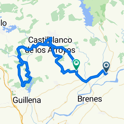
- Cantillana - Ruta del Agua
- Distance
- 104.7 km
- Ascent
- 1,080 m
- Descent
- 1,080 m
- Location
- Cantillana, Andalusia, Spain
- Montes UPA Almaden Melonares
- Distance
- 81.9 km
- Ascent
- 1,035 m
- Descent
- 1,035 m
- Location
- Cantillana, Andalusia, Spain
Open it in the app