

Hausruck Innviertel Runde
A cycling route starting in Zell am Pettenfirst, Upper Austria, Austria.
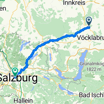
Overview
About this route
Hilly ups and downs on asphalt with beautiful views of Traunstein and Dachstein
- -:--
- Duration
- 61.4 km
- Distance
- 1,087 m
- Ascent
- 1,075 m
- Descent
- ---
- Avg. speed
- 728 m
- Max. altitude
Route quality
Waytypes & surfaces along the route
Waytypes
Quiet road
4.9 km
(8 %)
Road
3.1 km
(5 %)
Surfaces
Paved
20.2 km
(33 %)
Asphalt
20.2 km
(33 %)
Undefined
41.1 km
(67 %)
Continue with Bikemap
Use, edit, or download this cycling route
You would like to ride Hausruck Innviertel Runde or customize it for your own trip? Here is what you can do with this Bikemap route:
Free features
- Save this route as favorite or in collections
- Copy & plan your own version of this route
- Sync your route with Garmin or Wahoo
Premium features
Free trial for 3 days, or one-time payment. More about Bikemap Premium.
- Navigate this route on iOS & Android
- Export a GPX / KML file of this route
- Create your custom printout (try it for free)
- Download this route for offline navigation
Discover more Premium features.
Get Bikemap PremiumFrom our community
Other popular routes starting in Zell am Pettenfirst
 Kleine Hausruckrunde
- Distance
- 29.3 km
- Ascent
- 619 m
- Descent
- 628 m
- Location
- Zell am Pettenfirst, Upper Austria, Austria
 LItzing Runde Naturfreunde
- Distance
- 35.2 km
- Ascent
- 374 m
- Descent
- 374 m
- Location
- Zell am Pettenfirst, Upper Austria, Austria
 Kohlgrube
- Distance
- 42.9 km
- Ascent
- 889 m
- Descent
- 909 m
- Location
- Zell am Pettenfirst, Upper Austria, Austria
 Kleine Hausruck Runde
- Distance
- 29.2 km
- Ascent
- 608 m
- Descent
- 618 m
- Location
- Zell am Pettenfirst, Upper Austria, Austria
 Kleine Hausruck Runde
- Distance
- 29.5 km
- Ascent
- 623 m
- Descent
- 633 m
- Location
- Zell am Pettenfirst, Upper Austria, Austria
 Hausruck Inn 4tel Runde
- Distance
- 61.4 km
- Ascent
- 1,152 m
- Descent
- 1,145 m
- Location
- Zell am Pettenfirst, Upper Austria, Austria
 Hausruck Innviertel Runde
- Distance
- 61.4 km
- Ascent
- 1,087 m
- Descent
- 1,075 m
- Location
- Zell am Pettenfirst, Upper Austria, Austria
 Schablberg, Zell am Pettenfirst nach Mülln, Salzburg
- Distance
- 68.1 km
- Ascent
- 803 m
- Descent
- 942 m
- Location
- Zell am Pettenfirst, Upper Austria, Austria
Open it in the app