

Schilcherland - Rebenland
A cycling route starting in Eibiswald, Styria, Austria.
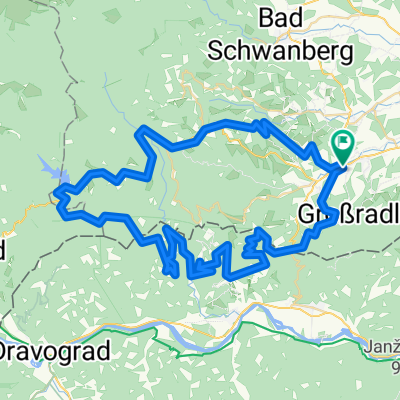
Overview
About this route
ca. 1.060 Höhenmeter
Fahrtzeit: ca. 4,5 Stunden <br />(gegen den Uhrzeiger)
Schwierigkeitsgrad/Kondition: ***
Panorama: ****
Ganzjahres-Tour (außer Schnee)
Highlight mir Panorama-Blick über
Hopfengärten und das Keltengebiet
- -:--
- Duration
- 62.5 km
- Distance
- 803 m
- Ascent
- 805 m
- Descent
- ---
- Avg. speed
- ---
- Max. altitude
Route quality
Waytypes & surfaces along the route
Waytypes
Quiet road
46.4 km
(74 %)
Busy road
12.6 km
(20 %)
Surfaces
Paved
39.9 km
(64 %)
Asphalt
37.3 km
(60 %)
Paved (undefined)
2.6 km
(4 %)
Undefined
22.6 km
(36 %)
Continue with Bikemap
Use, edit, or download this cycling route
You would like to ride Schilcherland - Rebenland or customize it for your own trip? Here is what you can do with this Bikemap route:
Free features
- Save this route as favorite or in collections
- Copy & plan your own version of this route
- Sync your route with Garmin or Wahoo
Premium features
Free trial for 3 days, or one-time payment. More about Bikemap Premium.
- Navigate this route on iOS & Android
- Export a GPX / KML file of this route
- Create your custom printout (try it for free)
- Download this route for offline navigation
Discover more Premium features.
Get Bikemap PremiumFrom our community
Other popular routes starting in Eibiswald
 Um den Kapuner
- Distance
- 30.6 km
- Ascent
- 873 m
- Descent
- 873 m
- Location
- Eibiswald, Styria, Austria
 Panorama-Tour um Eibiswald
- Distance
- 32.7 km
- Ascent
- 486 m
- Descent
- 486 m
- Location
- Eibiswald, Styria, Austria
 Odernik-Runde_2015
- Distance
- 28.9 km
- Ascent
- 708 m
- Descent
- 708 m
- Location
- Eibiswald, Styria, Austria
 Sv. Janez - Remschnik - St. Pongratzen
- Distance
- 47 km
- Ascent
- 1,191 m
- Descent
- 1,191 m
- Location
- Eibiswald, Styria, Austria
 Schmuckbauernwirt - St.Anna
- Distance
- 40.4 km
- Ascent
- 929 m
- Descent
- 929 m
- Location
- Eibiswald, Styria, Austria
 Zwei-Länder-Tour
- Distance
- 78.4 km
- Ascent
- 1,326 m
- Descent
- 1,326 m
- Location
- Eibiswald, Styria, Austria
 Slovenija-Avstrija
- Distance
- 77.1 km
- Ascent
- 941 m
- Descent
- 941 m
- Location
- Eibiswald, Styria, Austria
 Buchenberg-Tour
- Distance
- 23 km
- Ascent
- 545 m
- Descent
- 547 m
- Location
- Eibiswald, Styria, Austria
Open it in the app