

Jour 33 – Phonhong – Keune Kang
A cycling route starting in Muang Phôn-Hông, Vientiane Province, Laos.
Overview
About this route
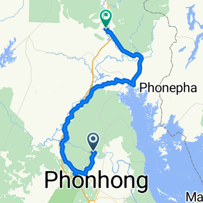
Day 33 – Phonhong – Keune Kang 62 km - Average 11.82 km/h Ascent 529 m – Max gradient 14 % (a few hundred meters) Thursday, 14 February 2013
- -:--
- Duration
- 60.4 km
- Distance
- 394 m
- Ascent
- 407 m
- Descent
- ---
- Avg. speed
- ---
- Max. altitude
Route quality
Waytypes & surfaces along the route
Waytypes
Road
16.3 km
(27 %)
Quiet road
7.3 km
(12 %)
Surfaces
Paved
39.9 km
(66 %)
Unpaved
1.8 km
(3 %)
Asphalt
27.2 km
(45 %)
Concrete
11.5 km
(19 %)
Continue with Bikemap
Use, edit, or download this cycling route
You would like to ride Jour 33 – Phonhong – Keune Kang or customize it for your own trip? Here is what you can do with this Bikemap route:
Free features
- Save this route as favorite or in collections
- Copy & plan your own version of this route
- Sync your route with Garmin or Wahoo
Premium features
Free trial for 3 days, or one-time payment. More about Bikemap Premium.
- Navigate this route on iOS & Android
- Export a GPX / KML file of this route
- Create your custom printout (try it for free)
- Download this route for offline navigation
Discover more Premium features.
Get Bikemap PremiumFrom our community
Other popular routes starting in Muang Phôn-Hông
 Phonehong to Vientiane
- Distance
- 104.7 km
- Ascent
- 89 m
- Descent
- 105 m
- Location
- Muang Phôn-Hông, Vientiane Province, Laos
 Nam Lik Ecovillage - Vang Vieng
- Distance
- 82.6 km
- Ascent
- 383 m
- Descent
- 338 m
- Location
- Muang Phôn-Hông, Vientiane Province, Laos
 Jour 33 – Phonhong – Keune Kang
- Distance
- 60.4 km
- Ascent
- 394 m
- Descent
- 407 m
- Location
- Muang Phôn-Hông, Vientiane Province, Laos
 LOcycle - Laos
- Distance
- 40.2 km
- Ascent
- 242 m
- Descent
- 212 m
- Location
- Muang Phôn-Hông, Vientiane Province, Laos
 Thalat - Van Vieng
- Distance
- 93 km
- Ascent
- 322 m
- Descent
- 268 m
- Location
- Muang Phôn-Hông, Vientiane Province, Laos
 Hinheup - ban keun
- Distance
- 49.3 km
- Ascent
- 179 m
- Descent
- 217 m
- Location
- Muang Phôn-Hông, Vientiane Province, Laos
 M) Thalat - Vientiane
- Distance
- 92.2 km
- Ascent
- 216 m
- Descent
- 237 m
- Location
- Muang Phôn-Hông, Vientiane Province, Laos
 LOcycle Laos
- Distance
- 65.6 km
- Ascent
- 526 m
- Descent
- 499 m
- Location
- Muang Phôn-Hông, Vientiane Province, Laos
Open it in the app