

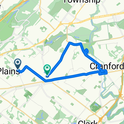
Pasaic River Hills Loop
A cycling route starting in Scotch Plains, New Jersey, United States.
Overview
About this route
2/16/13, 6:25 PM
- -:--
- Duration
- 36.5 km
- Distance
- 381 m
- Ascent
- 381 m
- Descent
- ---
- Avg. speed
- ---
- Max. altitude

Route quality
Waytypes & surfaces along the route
Waytypes
Road
25.4 km
(69 %)
Busy road
8.4 km
(23 %)
Surfaces
Paved
2 km
(5 %)
Asphalt
2 km
(5 %)
Undefined
34.6 km
(95 %)
Continue with Bikemap
Use, edit, or download this cycling route
You would like to ride Pasaic River Hills Loop or customize it for your own trip? Here is what you can do with this Bikemap route:
Free features
- Save this route as favorite or in collections
- Copy & plan your own version of this route
- Sync your route with Garmin or Wahoo
Premium features
Free trial for 3 days, or one-time payment. More about Bikemap Premium.
- Navigate this route on iOS & Android
- Export a GPX / KML file of this route
- Create your custom printout (try it for free)
- Download this route for offline navigation
Discover more Premium features.
Get Bikemap PremiumFrom our community
Other popular routes starting in Scotch Plains
 2530 John St, Westfield to 342 John St, Westfield
- Distance
- 19.8 km
- Ascent
- 89 m
- Descent
- 90 m
- Location
- Scotch Plains, New Jersey, United States
 2530 John St, Westfield to 901–999 Cleveland Ave, Westfield
- Distance
- 0.2 km
- Ascent
- 0 m
- Descent
- 0 m
- Location
- Scotch Plains, New Jersey, United States
 Northwest Westfield-> Scotch Plains -> Fanwood -> Brightwood Park
- Distance
- 17 km
- Ascent
- 30 m
- Descent
- 90 m
- Location
- Scotch Plains, New Jersey, United States
 342 John St, Westfield to Park Dr, Westfield
- Distance
- 20.5 km
- Ascent
- 67 m
- Descent
- 91 m
- Location
- Scotch Plains, New Jersey, United States
 Skytop Dr, Scotch Plains to 120 Pine Way, New Providence
- Distance
- 8.1 km
- Ascent
- 150 m
- Descent
- 174 m
- Location
- Scotch Plains, New Jersey, United States
 945 Cleveland Ave, Westfield to 342 John St, Westfield
- Distance
- 23.2 km
- Ascent
- 74 m
- Descent
- 75 m
- Location
- Scotch Plains, New Jersey, United States
 2530 John St, Westfield to 100–128 Mountain Ave, Westfield
- Distance
- 17.9 km
- Ascent
- 38 m
- Descent
- 65 m
- Location
- Scotch Plains, New Jersey, United States
 922 Cleveland Ave, Westfield to 20 Prospect St, Westfield
- Distance
- 21 km
- Ascent
- 45 m
- Descent
- 70 m
- Location
- Scotch Plains, New Jersey, United States
Open it in the app