

okolo Slovenskej brány
A cycling route starting in Levice, Nitra Region, Slovakia.
Overview
About this route
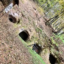
The route is mainly off-road, we move in the area of the Hron river gorge embraced by mountains. Along the route, there are several lookout points on rocks and a national cultural monument – the monastery in Hr. Beňadik.
- -:--
- Duration
- 53.2 km
- Distance
- 542 m
- Ascent
- 540 m
- Descent
- ---
- Avg. speed
- ---
- Max. altitude

Route highlights
Points of interest along the route
Point of interest after 22.5 km
vyhliadka z Hájskej skaly
Point of interest after 23 km
Point of interest after 31.1 km
vyhliadka Kňažské skaly
Point of interest after 31.1 km
Point of interest after 37.6 km
Krivín - najkrajší vyhliadkový bod trasy
Continue with Bikemap
Use, edit, or download this cycling route
You would like to ride okolo Slovenskej brány or customize it for your own trip? Here is what you can do with this Bikemap route:
Free features
- Save this route as favorite or in collections
- Copy & plan your own version of this route
- Sync your route with Garmin or Wahoo
Premium features
Free trial for 3 days, or one-time payment. More about Bikemap Premium.
- Navigate this route on iOS & Android
- Export a GPX / KML file of this route
- Create your custom printout (try it for free)
- Download this route for offline navigation
Discover more Premium features.
Get Bikemap PremiumFrom our community
Other popular routes starting in Levice
 Po dedinach Hontu
- Distance
- 73.9 km
- Ascent
- 723 m
- Descent
- 744 m
- Location
- Levice, Nitra Region, Slovakia
 Zuhra cez Svaty Kriz
- Distance
- 37.6 km
- Ascent
- 445 m
- Descent
- 486 m
- Location
- Levice, Nitra Region, Slovakia
 tolerančná lipa
- Distance
- 83.1 km
- Ascent
- 591 m
- Descent
- 591 m
- Location
- Levice, Nitra Region, Slovakia
 Levice - Dolná Seč - Kalná nad Hronom - Starý Tekov - Tlmače
- Distance
- 24 km
- Ascent
- 42 m
- Descent
- 30 m
- Location
- Levice, Nitra Region, Slovakia
 Siklós
- Distance
- 10.2 km
- Ascent
- 191 m
- Descent
- 151 m
- Location
- Levice, Nitra Region, Slovakia
 Beh na Šiklóš - Vinohrady - Trail
- Distance
- 9.7 km
- Ascent
- 138 m
- Descent
- 140 m
- Location
- Levice, Nitra Region, Slovakia
 Pohronská magistrála
- Distance
- 36 km
- Ascent
- 180 m
- Descent
- 182 m
- Location
- Levice, Nitra Region, Slovakia
 okolo Slovenskej brány
- Distance
- 53.2 km
- Ascent
- 542 m
- Descent
- 540 m
- Location
- Levice, Nitra Region, Slovakia
Open it in the app