Rund um die Talsperre Schönbrunn
A cycling route starting in Frauenwald, Thuringia, Germany.
Overview
About this route
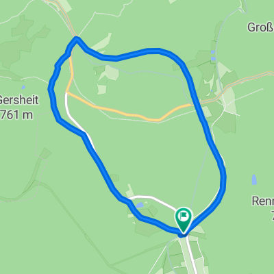
This tour leads directly along the water on mostly paved paths around the reservoir. The route has no significant ascents and does not go over public roads. Therefore, it is particularly suitable for families with children. Due to the mild climate, one can enjoy nature here from very early spring until well into autumn at pleasant temperatures. The well-wooded circular hiking trail also provides sufficient shade from the scorching sun in summer. Attention, the Schönbrunn dam is used for drinking water production, therefore there is a strict bathing prohibition here! Many beautiful resting places have been set up along the way, most of which offer a wonderful view of the lake. A tip from me: instead of a bathing suit, pack some refreshments for a nice picnic! Because having a picnic around the reservoir is really great. I wish you lots of fun!
- -:--
- Duration
- 16.3 km
- Distance
- 474 m
- Ascent
- 463 m
- Descent
- ---
- Avg. speed
- 678 m
- Max. altitude
Route quality
Waytypes & surfaces along the route
Waytypes
Track
15.7 km
(96 %)
Access road
0.7 km
(4 %)
Surfaces
Paved
6.4 km
(39 %)
Unpaved
10 km
(61 %)
Gravel
10 km
(61 %)
Asphalt
6.4 km
(39 %)
Continue with Bikemap
Use, edit, or download this cycling route
You would like to ride Rund um die Talsperre Schönbrunn or customize it for your own trip? Here is what you can do with this Bikemap route:
Free features
- Save this route as favorite or in collections
- Copy & plan your own version of this route
- Sync your route with Garmin or Wahoo
Premium features
Free trial for 3 days, or one-time payment. More about Bikemap Premium.
- Navigate this route on iOS & Android
- Export a GPX / KML file of this route
- Create your custom printout (try it for free)
- Download this route for offline navigation
Discover more Premium features.
Get Bikemap PremiumFrom our community
Other popular routes starting in Frauenwald
- Rund um die Talsperre Schönbrunn
- Distance
- 16.3 km
- Ascent
- 474 m
- Descent
- 463 m
- Location
- Frauenwald, Thuringia, Germany
- Frauenwald / Hörschel 2.Tag
- Distance
- 56 km
- Ascent
- 724 m
- Descent
- 1,298 m
- Location
- Frauenwald, Thuringia, Germany
- Von Frauenwald zu den schönsten Gipfeln
- Distance
- 51.7 km
- Ascent
- 865 m
- Descent
- 867 m
- Location
- Frauenwald, Thuringia, Germany
- Frauenwald - Neustadt - Schönbrunn - Frauenwald
- Distance
- 38.5 km
- Ascent
- 628 m
- Descent
- 626 m
- Location
- Frauenwald, Thuringia, Germany
- Talsperre/Dreiherrenstein
- Distance
- 12 km
- Ascent
- 315 m
- Descent
- 315 m
- Location
- Frauenwald, Thuringia, Germany
- Schönbrunn - Schneekopf
- Distance
- 60.2 km
- Ascent
- 1,377 m
- Descent
- 1,118 m
- Location
- Frauenwald, Thuringia, Germany
- Talsperre Schönbrunn (lang)
- Distance
- 16.3 km
- Ascent
- 414 m
- Descent
- 414 m
- Location
- Frauenwald, Thuringia, Germany
- Schönbrunn - Kickelhahn
- Distance
- 61.1 km
- Ascent
- 1,048 m
- Descent
- 1,058 m
- Location
- Frauenwald, Thuringia, Germany
Open it in the app