

Übers Eselseck
A cycling route starting in Hofheim am Taunus, Hesse, Germany.
Overview
About this route
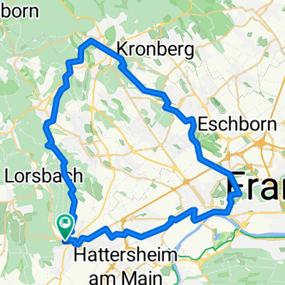
Von Hofheim (Start und Ziel ist der Bahnhof, S2) über Lorsbach, Eppstein, Ehlhalten, Heftrich, Kröftel und Glashütten am Fuß des Feldbergs über den "Eselseck" nach Königstein und Schnaidhain zurück nach Eppstein und Hofheim.
- -:--
- Duration
- 52.7 km
- Distance
- 843 m
- Ascent
- 797 m
- Descent
- ---
- Avg. speed
- 568 m
- Max. altitude
Route quality
Waytypes & surfaces along the route
Waytypes
Busy road
41.6 km
(79 %)
Quiet road
3.2 km
(6 %)
Surfaces
Paved
36.9 km
(70 %)
Unpaved
3.7 km
(7 %)
Asphalt
36.5 km
(69 %)
Gravel
2.6 km
(5 %)
Continue with Bikemap
Use, edit, or download this cycling route
You would like to ride Übers Eselseck or customize it for your own trip? Here is what you can do with this Bikemap route:
Free features
- Save this route as favorite or in collections
- Copy & plan your own version of this route
- Sync your route with Garmin or Wahoo
Premium features
Free trial for 3 days, or one-time payment. More about Bikemap Premium.
- Navigate this route on iOS & Android
- Export a GPX / KML file of this route
- Create your custom printout (try it for free)
- Download this route for offline navigation
Discover more Premium features.
Get Bikemap PremiumFrom our community
Other popular routes starting in Hofheim am Taunus
 Narturpark
- Distance
- 33.4 km
- Ascent
- 364 m
- Descent
- 380 m
- Location
- Hofheim am Taunus, Hesse, Germany
 Kids_Runde_190420
- Distance
- 43.3 km
- Ascent
- 407 m
- Descent
- 409 m
- Location
- Hofheim am Taunus, Hesse, Germany
 Nürnberg - Koblenz Etappe 11/13
- Distance
- 58.8 km
- Ascent
- 76 m
- Descent
- 131 m
- Location
- Hofheim am Taunus, Hesse, Germany
 RCH-StaufenBike, Tour 1
- Distance
- 50.8 km
- Ascent
- 941 m
- Descent
- 938 m
- Location
- Hofheim am Taunus, Hesse, Germany
 Langenhain, Diedenbergen, Wallau, Langenhain
- Distance
- 15.6 km
- Ascent
- 401 m
- Descent
- 355 m
- Location
- Hofheim am Taunus, Hesse, Germany
 Übers Eselseck
- Distance
- 52.7 km
- Ascent
- 843 m
- Descent
- 797 m
- Location
- Hofheim am Taunus, Hesse, Germany
 Einfache Fahrt in Hofheim am Taunus
- Distance
- 19.7 km
- Ascent
- 488 m
- Descent
- 489 m
- Location
- Hofheim am Taunus, Hesse, Germany
 Hfm-Lgh-Epp_Lob-Hof (19km)
- Distance
- 19.5 km
- Ascent
- 406 m
- Descent
- 406 m
- Location
- Hofheim am Taunus, Hesse, Germany
Open it in the app