

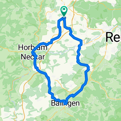
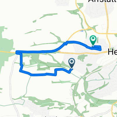
Schönbuchrunde
A cycling route starting in Herrenberg, Baden-Wurttemberg, Germany.
Overview
About this route
Start above Mönchberg via Weil im Schönbuch to Bebenhausen. Return via Hohenentringen Castle to the starting point.
- -:--
- Duration
- 39 km
- Distance
- 443 m
- Ascent
- 439 m
- Descent
- ---
- Avg. speed
- ---
- Max. altitude
Continue with Bikemap
Use, edit, or download this cycling route
You would like to ride Schönbuchrunde or customize it for your own trip? Here is what you can do with this Bikemap route:
Free features
- Save this route as favorite or in collections
- Copy & plan your own version of this route
- Sync your route with Garmin or Wahoo
Premium features
Free trial for 3 days, or one-time payment. More about Bikemap Premium.
- Navigate this route on iOS & Android
- Export a GPX / KML file of this route
- Create your custom printout (try it for free)
- Download this route for offline navigation
Discover more Premium features.
Get Bikemap PremiumFrom our community
Other popular routes starting in Herrenberg
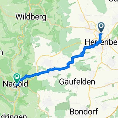 Nagold Tour
- Distance
- 15.7 km
- Ascent
- 208 m
- Descent
- 272 m
- Location
- Herrenberg, Baden-Wurttemberg, Germany
 170825Radfa
- Distance
- 103.5 km
- Ascent
- 1,312 m
- Descent
- 1,312 m
- Location
- Herrenberg, Baden-Wurttemberg, Germany
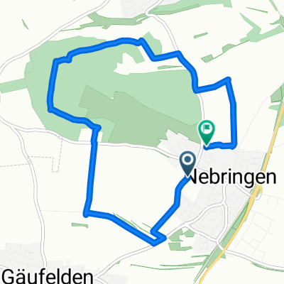 Großer Rundweg Nebringen
- Distance
- 7.4 km
- Ascent
- 111 m
- Descent
- 111 m
- Location
- Herrenberg, Baden-Wurttemberg, Germany
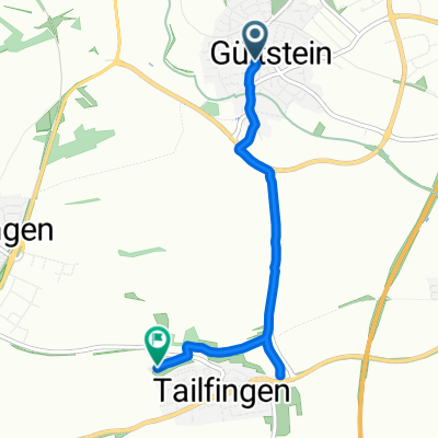 Zehnthofstraße nach Friesenstraße
- Distance
- 4.4 km
- Ascent
- 92 m
- Descent
- 103 m
- Location
- Herrenberg, Baden-Wurttemberg, Germany
 Von Herrenberg bis Meersburg 1
- Distance
- 159.9 km
- Ascent
- 2,222 m
- Descent
- 2,252 m
- Location
- Herrenberg, Baden-Wurttemberg, Germany
 Cottbuser Straße, Herrenberg nach Tannenstraße, Herrenberg
- Distance
- 4.7 km
- Ascent
- 109 m
- Descent
- 102 m
- Location
- Herrenberg, Baden-Wurttemberg, Germany
 Schönbuch Runde
- Distance
- 51.4 km
- Ascent
- 475 m
- Descent
- 465 m
- Location
- Herrenberg, Baden-Wurttemberg, Germany
 Herrenberg - Wurmlinger Kapelle - Rottenburg - Herrenberg
- Distance
- 42.2 km
- Ascent
- 305 m
- Descent
- 305 m
- Location
- Herrenberg, Baden-Wurttemberg, Germany
Open it in the app