

Temuco - Villarrica - Pucón - Coñaripe - Panguipulli
A cycling route starting in Temuco, Región de la Araucanía, Chile.
Overview
About this route
- -:--
- Duration
- 217.6 km
- Distance
- 1,911 m
- Ascent
- 1,881 m
- Descent
- ---
- Avg. speed
- ---
- Max. altitude

Route highlights
Points of interest along the route

Photo after 115.8 km

Photo after 146.4 km

Photo after 187.6 km
Continue with Bikemap
Use, edit, or download this cycling route
You would like to ride Temuco - Villarrica - Pucón - Coñaripe - Panguipulli or customize it for your own trip? Here is what you can do with this Bikemap route:
Free features
- Save this route as favorite or in collections
- Copy & plan your own version of this route
- Split it into stages to create a multi-day tour
- Sync your route with Garmin or Wahoo
Premium features
Free trial for 3 days, or one-time payment. More about Bikemap Premium.
- Navigate this route on iOS & Android
- Export a GPX / KML file of this route
- Create your custom printout (try it for free)
- Download this route for offline navigation
Discover more Premium features.
Get Bikemap PremiumFrom our community
Other popular routes starting in Temuco
 3 Cerros
- Distance
- 67.2 km
- Ascent
- 1,369 m
- Descent
- 1,366 m
- Location
- Temuco, Región de la Araucanía, Chile
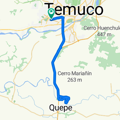 Río Quepe 2.0 - 34K, 90% asfalto
- Distance
- 34.1 km
- Ascent
- 179 m
- Descent
- 178 m
- Location
- Temuco, Región de la Araucanía, Chile
 De 3 Norte / Los Avellanos, Temuco a Los Chilcos / Los Avellanos - Sur, Temuco
- Distance
- 5.6 km
- Ascent
- 31 m
- Descent
- 31 m
- Location
- Temuco, Región de la Araucanía, Chile
 Outdoor Sportlife Temuco - Trañi Trañi
- Distance
- 20.5 km
- Ascent
- 156 m
- Descent
- 157 m
- Location
- Temuco, Región de la Araucanía, Chile
 Ruta vuelta río cautín, puente entre rios
- Distance
- 41.4 km
- Ascent
- 187 m
- Descent
- 182 m
- Location
- Temuco, Región de la Araucanía, Chile
 Outdoor Sportlife Temuco - Parapente con Choripán
- Distance
- 19.6 km
- Ascent
- 315 m
- Descent
- 310 m
- Location
- Temuco, Región de la Araucanía, Chile
 Cerro Ñielol Asfalto
- Distance
- 3.6 km
- Ascent
- 146 m
- Descent
- 144 m
- Location
- Temuco, Región de la Araucanía, Chile
 sendero principal
- Distance
- 2.6 km
- Ascent
- 233 m
- Descent
- 61 m
- Location
- Temuco, Región de la Araucanía, Chile
Open it in the app