

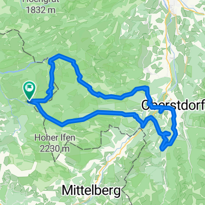
Sibratsgfäll - Allgäu - Lechtal - Warth - Schoppernau - Egg - Hittisau - Sibratsgfäll
A cycling route starting in Sibratsgfäll, Vorarlberg, Austria.
Overview
About this route
Sibratsgfäll - Allgäu - Lechtal - Warth - Schoppernau - Egg - Hittisau - Sibratsgfäll
- -:--
- Duration
- 185.6 km
- Distance
- 1,897 m
- Ascent
- 1,902 m
- Descent
- ---
- Avg. speed
- ---
- Max. altitude
Route quality
Waytypes & surfaces along the route
Waytypes
Quiet road
33.4 km
(18 %)
Road
13 km
(7 %)
Surfaces
Paved
165.2 km
(89 %)
Unpaved
13 km
(7 %)
Asphalt
165.2 km
(89 %)
Gravel
9.3 km
(5 %)
Continue with Bikemap
Use, edit, or download this cycling route
You would like to ride Sibratsgfäll - Allgäu - Lechtal - Warth - Schoppernau - Egg - Hittisau - Sibratsgfäll or customize it for your own trip? Here is what you can do with this Bikemap route:
Free features
- Save this route as favorite or in collections
- Copy & plan your own version of this route
- Split it into stages to create a multi-day tour
- Sync your route with Garmin or Wahoo
Premium features
Free trial for 3 days, or one-time payment. More about Bikemap Premium.
- Navigate this route on iOS & Android
- Export a GPX / KML file of this route
- Create your custom printout (try it for free)
- Download this route for offline navigation
Discover more Premium features.
Get Bikemap PremiumFrom our community
Other popular routes starting in Sibratsgfäll
 TransAllgäu e3 option 1
- Distance
- 49.8 km
- Ascent
- 1,487 m
- Descent
- 1,699 m
- Location
- Sibratsgfäll, Vorarlberg, Austria
 Oberallgäuer Viertälerrunde
- Distance
- 60.5 km
- Ascent
- 1,881 m
- Descent
- 1,881 m
- Location
- Sibratsgfäll, Vorarlberg, Austria
 Balderschwang 42 km
- Distance
- 41.6 km
- Ascent
- 1,211 m
- Descent
- 1,325 m
- Location
- Sibratsgfäll, Vorarlberg, Austria
 Sibratsgfäll - Hittisau - Krumbach - Riefensberg - Sulzberg - Doren - Krumbach - Sibratsgfäll
- Distance
- 46.4 km
- Ascent
- 1,077 m
- Descent
- 1,077 m
- Location
- Sibratsgfäll, Vorarlberg, Austria
 Wildromantische Biketour
- Distance
- 47.2 km
- Ascent
- 1,197 m
- Descent
- 1,193 m
- Location
- Sibratsgfäll, Vorarlberg, Austria
 Sibratsgfäll - Rohrmoos - Tiefenbach - Balderschwang - Sibratsgfäll
- Distance
- 50 km
- Ascent
- 1,006 m
- Descent
- 1,006 m
- Location
- Sibratsgfäll, Vorarlberg, Austria
 Sibratsgfäll - Rohrmoos - Tiefenbach - Balderschwang - Sibratsgfäll
- Distance
- 56.8 km
- Ascent
- 1,088 m
- Descent
- 1,087 m
- Location
- Sibratsgfäll, Vorarlberg, Austria
 Schetteregg, Schönenbach, Bezau, Egg
- Distance
- 33.1 km
- Ascent
- 459 m
- Descent
- 984 m
- Location
- Sibratsgfäll, Vorarlberg, Austria
Open it in the app