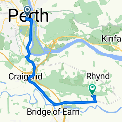
St Columba's Way- Perth to St Andrews
A cycling route starting in Perth, Scotland, United Kingdom.
Overview
About this route
Cross bridge in Perth on Bike Route 77 and then follow quiet roads, riverside tracks and core paths. A bit hilly at first, up to 145 metres outside Perth, and then flat all the way with lovely views over the River Tay to Dundee and the famous railway bridge. Plenty of accommodation, pubs etc in Dundee.
Special Report. Avoid the dangerous rush, swamp and muddy areas on side of the Tay south of St Madoes and Errol.
From Dundee cross the road bridge onto Fife Coastal Path until heading inland along quiet roads and pedestrian walkways to St Andrews.
This is the 7th and final section of St Columba's Way, from Iona to St Andrews (website:http://www.thewayofstandrews.com)
- -:--
- Duration
- 73.2 km
- Distance
- 266 m
- Ascent
- 249 m
- Descent
- ---
- Avg. speed
- ---
- Avg. speed
Route quality
Waytypes & surfaces along the route
Waytypes
Path
19.1 km
(26 %)
Road
12.5 km
(17 %)
Surfaces
Paved
30.6 km
(42 %)
Unpaved
7 km
(10 %)
Asphalt
29.3 km
(40 %)
Gravel
6.2 km
(8 %)
Route highlights
Points of interest along the route
Point of interest after 8.6 km
BIKE ROUTE 77. Signposted from Perth to Dundee
Point of interest after 40.7 km
DUNDEE. Hotels, hostels, shops, pubs etc
Point of interest after 65.3 km
Guardbridge. The village derives its name from this 15th-century six-arched bridge over the Eden and is the site of the last hostel – or “gare” from the French word for station - where many pilgrims stayed before setting off on the final three miles (5 km) to St Andrews and the great cathedral holding the relics of St Andrew.
Continue with Bikemap
Use, edit, or download this cycling route
You would like to ride St Columba's Way- Perth to St Andrews or customize it for your own trip? Here is what you can do with this Bikemap route:
Free features
- Save this route as favorite or in collections
- Copy & plan your own version of this route
- Sync your route with Garmin or Wahoo
Premium features
Free trial for 3 days, or one-time payment. More about Bikemap Premium.
- Navigate this route on iOS & Android
- Export a GPX / KML file of this route
- Create your custom printout (try it for free)
- Download this route for offline navigation
Discover more Premium features.
Get Bikemap PremiumFrom our community
Other popular routes starting in Perth
- Moderate route in Perth
- Distance
- 14.1 km
- Ascent
- 15 m
- Descent
- 17 m
- Location
- Perth, Scotland, United Kingdom
- 50 Manson Crescent, Perth to 50 Manson Crescent, Perth
- Distance
- 47.8 km
- Ascent
- 328 m
- Descent
- 330 m
- Location
- Perth, Scotland, United Kingdom
- Perth circular 2
- Distance
- 10.8 km
- Ascent
- 10 m
- Descent
- 9 m
- Location
- Perth, Scotland, United Kingdom
- JOGLE Day 7
- Distance
- 95.8 km
- Ascent
- 448 m
- Descent
- 471 m
- Location
- Perth, Scotland, United Kingdom
- almost mailer hill
- Distance
- 5.1 km
- Ascent
- 142 m
- Descent
- 147 m
- Location
- Perth, Scotland, United Kingdom
- 2010 - Scozia
- Distance
- 236.5 km
- Ascent
- 658 m
- Descent
- 557 m
- Location
- Perth, Scotland, United Kingdom
- Perth North Circular through Stanley
- Distance
- 39.3 km
- Ascent
- 269 m
- Descent
- 268 m
- Location
- Perth, Scotland, United Kingdom
- St Columba's Way-Perth to Amulree
- Distance
- 53.7 km
- Ascent
- 729 m
- Descent
- 469 m
- Location
- Perth, Scotland, United Kingdom