

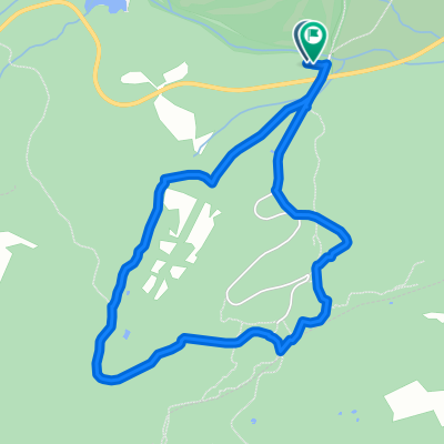
valmayor
A cycling route starting in El Escorial, Madrid, Spain.
Overview
About this route
- -:--
- Duration
- 38.2 km
- Distance
- 357 m
- Ascent
- 360 m
- Descent
- ---
- Avg. speed
- ---
- Max. altitude
Continue with Bikemap
Use, edit, or download this cycling route
You would like to ride valmayor or customize it for your own trip? Here is what you can do with this Bikemap route:
Free features
- Save this route as favorite or in collections
- Copy & plan your own version of this route
- Sync your route with Garmin or Wahoo
Premium features
Free trial for 3 days, or one-time payment. More about Bikemap Premium.
- Navigate this route on iOS & Android
- Export a GPX / KML file of this route
- Create your custom printout (try it for free)
- Download this route for offline navigation
Discover more Premium features.
Get Bikemap PremiumFrom our community
Other popular routes starting in El Escorial
 San Lorenzo del Escorial- Navacerrada
- Distance
- 54.9 km
- Ascent
- 594 m
- Descent
- 640 m
- Location
- El Escorial, Madrid, Spain
 Subida a Abantos
- Distance
- 27.5 km
- Ascent
- 663 m
- Descent
- 662 m
- Location
- El Escorial, Madrid, Spain
 Silla de Felipe II
- Distance
- 4.5 km
- Ascent
- 129 m
- Descent
- 131 m
- Location
- El Escorial, Madrid, Spain
 Abantose-bike
- Distance
- 26.8 km
- Ascent
- 1,432 m
- Descent
- 1,432 m
- Location
- El Escorial, Madrid, Spain
 ABANTOS
- Distance
- 9.6 km
- Ascent
- 662 m
- Descent
- 662 m
- Location
- El Escorial, Madrid, Spain
 Valdeperial Cobarde
- Distance
- 58.8 km
- Ascent
- 919 m
- Descent
- 923 m
- Location
- El Escorial, Madrid, Spain
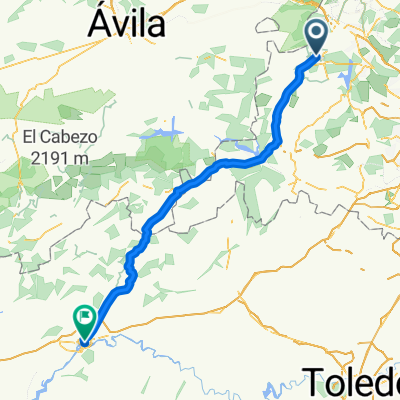 2000 - san lorenzo del escorial - talavera de la reina - 110 km - 1660 d
- Distance
- 110.3 km
- Ascent
- 869 m
- Descent
- 1,564 m
- Location
- El Escorial, Madrid, Spain
 Silla de Felipe II
- Distance
- 20.4 km
- Ascent
- 330 m
- Descent
- 330 m
- Location
- El Escorial, Madrid, Spain
Open it in the app