

2011 Langogne-Cahors en Vélofamille 3 enfants
A cycling route starting in Langogne, Occitanie, France.
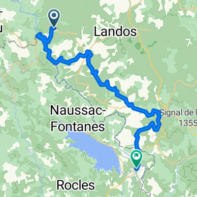
Overview
About this route
Downhill route profile, magnificent landscapes but cold and headwind in the mountains, calmer along the Lot.
- -:--
- Duration
- 296.8 km
- Distance
- 1,110 m
- Ascent
- 1,888 m
- Descent
- ---
- Avg. speed
- ---
- Max. altitude

Route quality
Waytypes & surfaces along the route
Waytypes
Road
109.8 km
(37 %)
Quiet road
26.7 km
(9 %)
Surfaces
Paved
148.4 km
(50 %)
Unpaved
3 km
(1 %)
Asphalt
139.5 km
(47 %)
Paved (undefined)
8.9 km
(3 %)
Route highlights
Points of interest along the route

Point of interest after 33.7 km
1er jour: Gîte au Giraldès

Point of interest after 39.3 km
Col du Cheval Mort, vent de face et dans le froid!

Point of interest after 73.5 km
2eme Jour : Gîte au Gilbertès

Point of interest after 78.6 km
Rencontres à vélo sur les plateaux de l'Aubrac

Point of interest after 265.6 km
Sur le chemin de halage St Cirq la Popie
Continue with Bikemap
Use, edit, or download this cycling route
You would like to ride 2011 Langogne-Cahors en Vélofamille 3 enfants or customize it for your own trip? Here is what you can do with this Bikemap route:
Free features
- Save this route as favorite or in collections
- Copy & plan your own version of this route
- Split it into stages to create a multi-day tour
- Sync your route with Garmin or Wahoo
Premium features
Free trial for 3 days, or one-time payment. More about Bikemap Premium.
- Navigate this route on iOS & Android
- Export a GPX / KML file of this route
- Create your custom printout (try it for free)
- Download this route for offline navigation
Discover more Premium features.
Get Bikemap PremiumFrom our community
Other popular routes starting in Langogne
 7. Chapeauroux - Saint-Chély d'Apcher
- Distance
- 55.6 km
- Ascent
- 896 m
- Descent
- 713 m
- Location
- Langogne, Occitanie, France
 2015 L'Allier-Loire-Canal du Centre
- Distance
- 568.4 km
- Ascent
- 759 m
- Descent
- 1,745 m
- Location
- Langogne, Occitanie, France
 LV0B prologue from Langogne.kml - LV0B prologue from Langogne.kml_LV0B prologue from Langogne
- Distance
- 50.5 km
- Ascent
- 1,847 m
- Descent
- 1,375 m
- Location
- Langogne, Occitanie, France
 Saint Bonnet, Chapeauroux, Joncherette
- Distance
- 40.5 km
- Ascent
- 625 m
- Descent
- 610 m
- Location
- Langogne, Occitanie, France
 Et. 7 Saint-Haon / Langogne
- Distance
- 34.1 km
- Ascent
- 1,052 m
- Descent
- 1,136 m
- Location
- Langogne, Occitanie, France
 02ColduChevalMort
- Distance
- 116 km
- Ascent
- 1,944 m
- Descent
- 1,945 m
- Location
- Langogne, Occitanie, France
 2011 Langogne-Cahors en Vélofamille 3 enfants
- Distance
- 296.8 km
- Ascent
- 1,110 m
- Descent
- 1,888 m
- Location
- Langogne, Occitanie, France
 Tour du Lac
- Distance
- 28 km
- Ascent
- 360 m
- Descent
- 364 m
- Location
- Langogne, Occitanie, France
Open it in the app