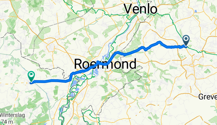


Amerner Runde von Viersen 38 km
- 38 km
- 140 m
- 137 m
- Viersen, North Rhine-Westphalia, Germany
A cycling route starting in Viersen, North Rhine-Westphalia, Germany.
Overview
At Pr. to Freihenstrrasse, 200 m right and at L Lindenstr. Peterstr., before and after P NETTO. Then through L 39 Lohweg, behind the fields right to Dulkener str., and left no. 7, after A to Dulken L 29, right at ALDI, L 29 to Boisheim and left L373 to Bruggen (17 km), bypass right or straight to Swalmen L 373, but before Swalme, after the ponds, turn left and look for accommodation (26.5 km).
Across the border CAMP right and after 2 km left and through Swalmen left - N271 to Roemond (33 km), after A right from N 271 to Venloseweg, right and left to the bridge, loop right on the canal bank and right to Begden, Heel, Panheel, straight after the canal (47.7 km) to Ittervoort, then N 78 2 km and right N 73 to Kinrooi (50 km), straight to Bree (67 km).
created this 13 years ago
Continue with Bikemap
You would like to ride 1) Viersen - or customize it for your own trip? Here is what you can do with this Bikemap route:
Free trial for 3 days, or one-time payment. More about Bikemap Premium.
Discover more Premium features.
Get Bikemap PremiumFrom our community
Open it in the app