

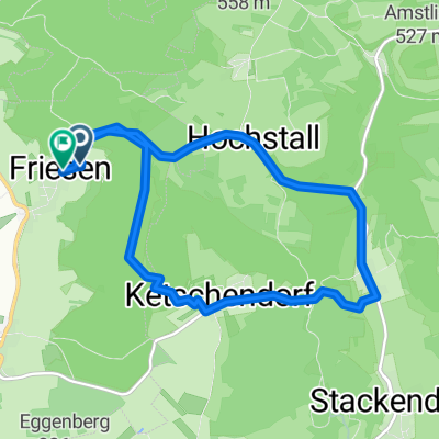
Buttenheim-Ketschendorf-Senftenberg Keller-Buttenheim
A cycling route starting in Buttenheim, Bavaria, Germany.
Overview
About this route
- -:--
- Duration
- 10 km
- Distance
- 236 m
- Ascent
- 233 m
- Descent
- ---
- Avg. speed
- ---
- Max. altitude

Route quality
Waytypes & surfaces along the route
Waytypes
Track
6.3 km
(63 %)
Road
2.5 km
(25 %)
Surfaces
Paved
5 km
(50 %)
Unpaved
3.4 km
(34 %)
Asphalt
4.5 km
(45 %)
Loose gravel
1.9 km
(19 %)
Continue with Bikemap
Use, edit, or download this cycling route
You would like to ride Buttenheim-Ketschendorf-Senftenberg Keller-Buttenheim or customize it for your own trip? Here is what you can do with this Bikemap route:
Free features
- Save this route as favorite or in collections
- Copy & plan your own version of this route
- Sync your route with Garmin or Wahoo
Premium features
Free trial for 3 days, or one-time payment. More about Bikemap Premium.
- Navigate this route on iOS & Android
- Export a GPX / KML file of this route
- Create your custom printout (try it for free)
- Download this route for offline navigation
Discover more Premium features.
Get Bikemap PremiumFrom our community
Other popular routes starting in Buttenheim
 Brauerei- und Bierkellertour FO1
- Distance
- 35 km
- Ascent
- 335 m
- Descent
- 343 m
- Location
- Buttenheim, Bavaria, Germany
 Rundkurs Schießberg-Senftenberg-Almadler-Kalteneggolsfeld-TiefenstürmigKautschenberg-Gunzendorf-Dreuschendorf-Buttenheim
- Distance
- 31.7 km
- Ascent
- 593 m
- Descent
- 598 m
- Location
- Buttenheim, Bavaria, Germany
 Buttenheim-Rothenburg o d T-Großeicholzheim
- Distance
- 198.9 km
- Ascent
- 1,155 m
- Descent
- 1,138 m
- Location
- Buttenheim, Bavaria, Germany
 Von Buttenheim bis Bamberg
- Distance
- 37.5 km
- Ascent
- 204 m
- Descent
- 222 m
- Location
- Buttenheim, Bavaria, Germany
 Buttenheim-Leinleitertal und zurück
- Distance
- 47.7 km
- Ascent
- 648 m
- Descent
- 559 m
- Location
- Buttenheim, Bavaria, Germany
 sonntagsrunde friesener warte
- Distance
- 9.6 km
- Ascent
- 460 m
- Descent
- 477 m
- Location
- Buttenheim, Bavaria, Germany
 Kanal-Strullendorf-Amlingstadt-Wernsdorf-Leesten-Friesen-Buttenheim
- Distance
- 25.5 km
- Ascent
- 305 m
- Descent
- 297 m
- Location
- Buttenheim, Bavaria, Germany
 Aussichtspunkt Walberla - Am Kanal - über Hallerndorf
- Distance
- 29.8 km
- Ascent
- 306 m
- Descent
- 306 m
- Location
- Buttenheim, Bavaria, Germany
Open it in the app