

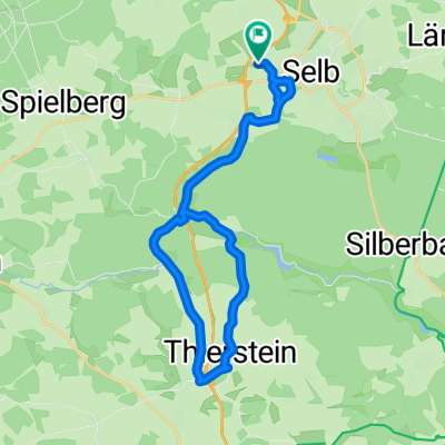
Zwischen Selb und großem Kornberg
A cycling route starting in Selb, Bavaria, Germany.
Overview
About this route
Route
Selb* — Erkersreuth* — Lauterbach — Neuhausen, Schönlind — Schönwald* — Parsonage Grötschenreuth*, Pilgramsreuth* — Vorsuchhütte — Spielberg* — Heidelheim* — Schwarzenhammer* — Selb*
Difficulty level
As a sporty family tour with some larger climbs and descents, the cycle path can be well ridden on many of the flatter sections.
Possible connecting routes to other tours
"Eger Cycle Path", "Borderland Cycle Path" as well as the circular cycle routes "Sechsämter Cycle Path", "From Selb to the Eger Valley and the Selb Forest".
Rail connections
Selb, Selb-Nord, Selb-Erkersreuth
- -:--
- Duration
- 46.7 km
- Distance
- 562 m
- Ascent
- 562 m
- Descent
- ---
- Avg. speed
- ---
- Max. altitude
Route quality
Waytypes & surfaces along the route
Waytypes
Track
21 km
(45 %)
Quiet road
18.7 km
(40 %)
Surfaces
Paved
3.7 km
(8 %)
Unpaved
22 km
(47 %)
Gravel
19.2 km
(41 %)
Asphalt
3.3 km
(7 %)
Continue with Bikemap
Use, edit, or download this cycling route
You would like to ride Zwischen Selb und großem Kornberg or customize it for your own trip? Here is what you can do with this Bikemap route:
Free features
- Save this route as favorite or in collections
- Copy & plan your own version of this route
- Sync your route with Garmin or Wahoo
Premium features
Free trial for 3 days, or one-time payment. More about Bikemap Premium.
- Navigate this route on iOS & Android
- Export a GPX / KML file of this route
- Create your custom printout (try it for free)
- Download this route for offline navigation
Discover more Premium features.
Get Bikemap PremiumFrom our community
Other popular routes starting in Selb
 Wellertal- Historische Grenzsteine
- Distance
- 31 km
- Ascent
- 324 m
- Descent
- 326 m
- Location
- Selb, Bavaria, Germany
 Selb-Kirchenlamitz
- Distance
- 17.9 km
- Ascent
- 239 m
- Descent
- 196 m
- Location
- Selb, Bavaria, Germany
 16K Weißenbach_Rondell_Kaiserhammer_Weißenbach
- Distance
- 16.2 km
- Ascent
- 246 m
- Descent
- 249 m
- Location
- Selb, Bavaria, Germany
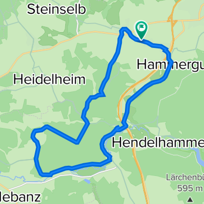
 SelbThiersteinHendelhammer
- Distance
- 22.4 km
- Ascent
- 243 m
- Descent
- 245 m
- Location
- Selb, Bavaria, Germany
 Teiche um Selb
- Distance
- 14.7 km
- Ascent
- 151 m
- Descent
- 157 m
- Location
- Selb, Bavaria, Germany
 Zwischen Selb und großem Kornberg
- Distance
- 46.7 km
- Ascent
- 562 m
- Descent
- 562 m
- Location
- Selb, Bavaria, Germany
 Elsterquellenrunde
- Distance
- 32.6 km
- Ascent
- 350 m
- Descent
- 347 m
- Location
- Selb, Bavaria, Germany
 Franzensbader Straße 6, Selb nach Christian-Höfer-Ring 6, Selb
- Distance
- 22.3 km
- Ascent
- 336 m
- Descent
- 322 m
- Location
- Selb, Bavaria, Germany
Open it in the app