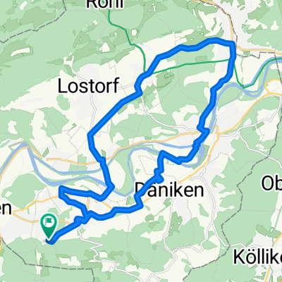
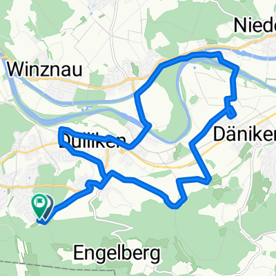
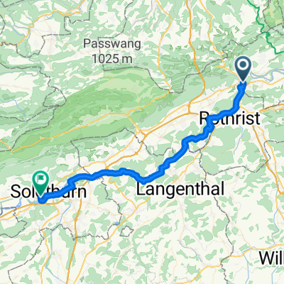
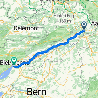
Olten - Moutier
A cycling route starting in Olten, Canton of Solothurn, Switzerland.
Overview
About this route
This routes mainly consist of Paved sections. However it can't be done with the race bike since some sections are heavy gravel.
The landscape in this area is just amazing.. nothing to envy to the Alps! ;-)
You can easily slightly change the route in order to make it suitable for race bike.
- -:--
- Duration
- 58.8 km
- Distance
- 2,201 m
- Ascent
- 1,802 m
- Descent
- ---
- Avg. speed
- 1,187 m
- Avg. speed
Route quality
Waytypes & surfaces along the route
Waytypes
Quiet road
22.2 km
(38 %)
Track
13.6 km
(23 %)
Surfaces
Paved
26.9 km
(46 %)
Unpaved
13 km
(22 %)
Asphalt
25.3 km
(43 %)
Gravel
7.5 km
(13 %)
Continue with Bikemap
Use, edit, or download this cycling route
You would like to ride Olten - Moutier or customize it for your own trip? Here is what you can do with this Bikemap route:
Free features
- Save this route as favorite or in collections
- Copy & plan your own version of this route
- Sync your route with Garmin or Wahoo
Premium features
Free trial for 3 days, or one-time payment. More about Bikemap Premium.
- Navigate this route on iOS & Android
- Export a GPX / KML file of this route
- Create your custom printout (try it for free)
- Download this route for offline navigation
Discover more Premium features.
Get Bikemap PremiumFrom our community
Other popular routes starting in Olten
- Olten - Moutier
- Distance
- 58.8 km
- Ascent
- 2,201 m
- Descent
- 1,802 m
- Location
- Olten, Canton of Solothurn, Switzerland
- Schafmattrunde Olten
- Distance
- 37.3 km
- Ascent
- 909 m
- Descent
- 890 m
- Location
- Olten, Canton of Solothurn, Switzerland
- Olten - Mümliswil - Brunnersberg - Kestenholz
- Distance
- 93.5 km
- Ascent
- 1,455 m
- Descent
- 1,454 m
- Location
- Olten, Canton of Solothurn, Switzerland
- Schützenmattweg 12, Olten nach Forstackerstrasse 4F, Zofingen
- Distance
- 10 km
- Ascent
- 84 m
- Descent
- 38 m
- Location
- Olten, Canton of Solothurn, Switzerland
- 20151113 AG/BL/SO-Combo
- Distance
- 60.1 km
- Ascent
- 1,419 m
- Descent
- 1,419 m
- Location
- Olten, Canton of Solothurn, Switzerland
- Glaubenberg, Glaubenbüehlen, Lüderealp
- Distance
- 208.4 km
- Ascent
- 2,690 m
- Descent
- 2,703 m
- Location
- Olten, Canton of Solothurn, Switzerland
- Olten - Hauenstein - Schaafmatt - Olten
- Distance
- 31.5 km
- Ascent
- 652 m
- Descent
- 655 m
- Location
- Olten, Canton of Solothurn, Switzerland
- Scheltenpass mit Weissenstein
- Distance
- 79.6 km
- Ascent
- 1,597 m
- Descent
- 1,558 m
- Location
- Olten, Canton of Solothurn, Switzerland