

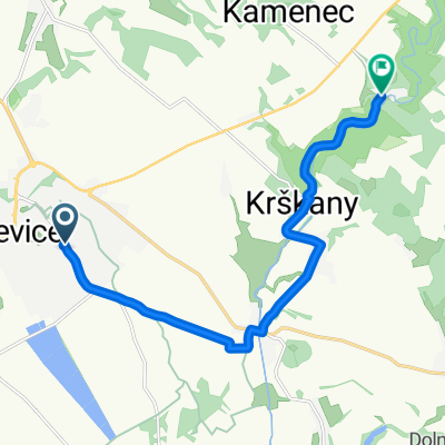
časovka do vrchu Tlstý vrch
A cycling route starting in Levice, Nitra Region, Slovakia.
Overview
About this route
<p>Route parameters:</p>
<p>Length ................. 6.74 km</p>
<p>Elevation gain .......... 200 m</p>
<p>Average gradient ....... 2.96 %</p>
Translated, show original (Polish)- -:--
- Duration
- 6.7 km
- Distance
- 208 m
- Ascent
- 17 m
- Descent
- ---
- Avg. speed
- ---
- Max. altitude

Route quality
Waytypes & surfaces along the route
Waytypes
Track
0.5 km
(8 %)
Undefined
6.2 km
(92 %)
Surfaces
Paved
6.2 km
(92 %)
Unpaved
0.5 km
(8 %)
Asphalt
6.2 km
(92 %)
Ground
0.5 km
(8 %)
Continue with Bikemap
Use, edit, or download this cycling route
You would like to ride časovka do vrchu Tlstý vrch or customize it for your own trip? Here is what you can do with this Bikemap route:
Free features
- Save this route as favorite or in collections
- Copy & plan your own version of this route
- Sync your route with Garmin or Wahoo
Premium features
Free trial for 3 days, or one-time payment. More about Bikemap Premium.
- Navigate this route on iOS & Android
- Export a GPX / KML file of this route
- Create your custom printout (try it for free)
- Download this route for offline navigation
Discover more Premium features.
Get Bikemap PremiumFrom our community
Other popular routes starting in Levice
 vozokanský lev
- Distance
- 74.8 km
- Ascent
- 282 m
- Descent
- 281 m
- Location
- Levice, Nitra Region, Slovakia
 tolerančná lipa
- Distance
- 83.1 km
- Ascent
- 591 m
- Descent
- 591 m
- Location
- Levice, Nitra Region, Slovakia
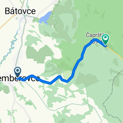
 Levice - Staré Levice - Veľké Krškany - Horša
- Distance
- 11.3 km
- Ascent
- 111 m
- Descent
- 95 m
- Location
- Levice, Nitra Region, Slovakia
 Extrem Tri vrchy
- Distance
- 166.3 km
- Ascent
- 2,904 m
- Descent
- 2,904 m
- Location
- Levice, Nitra Region, Slovakia
 okolo Slovenskej brány
- Distance
- 53.2 km
- Ascent
- 542 m
- Descent
- 540 m
- Location
- Levice, Nitra Region, Slovakia
 Pohronská magistrála
- Distance
- 36 km
- Ascent
- 180 m
- Descent
- 182 m
- Location
- Levice, Nitra Region, Slovakia
 časovka do vrchu Tlstý vrch
- Distance
- 6.7 km
- Ascent
- 208 m
- Descent
- 17 m
- Location
- Levice, Nitra Region, Slovakia
 Zuhra cez Svaty Kriz
- Distance
- 37.6 km
- Ascent
- 445 m
- Descent
- 486 m
- Location
- Levice, Nitra Region, Slovakia
Open it in the app