
Ferrovie Dimenticate 2013
A cycling route starting in Udine, Friuli Venezia Giulia, Italy.
Overview
About this route
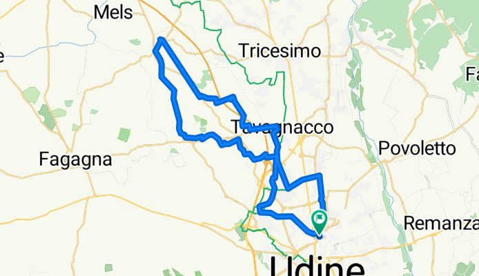
Rolling route without particular inclines, designed to recover and revitalize the old trackbed of the former ghost railway Udine-Majano. Particularly pleasant from a scenic point of view.
- -:--
- Duration
- 36 km
- Distance
- 205 m
- Ascent
- 203 m
- Descent
- ---
- Avg. speed
- ---
- Max. altitude

Route quality
Waytypes & surfaces along the route
Waytypes
Quiet road
19.4 km
(54 %)
Cycleway
5.4 km
(15 %)
Surfaces
Paved
22.3 km
(62 %)
Unpaved
4 km
(11 %)
Asphalt
22 km
(61 %)
Unpaved (undefined)
1.4 km
(4 %)
Continue with Bikemap
Use, edit, or download this cycling route
You would like to ride Ferrovie Dimenticate 2013 or customize it for your own trip? Here is what you can do with this Bikemap route:
Free features
- Save this route as favorite or in collections
- Copy & plan your own version of this route
- Sync your route with Garmin or Wahoo
Premium features
Free trial for 3 days, or one-time payment. More about Bikemap Premium.
- Navigate this route on iOS & Android
- Export a GPX / KML file of this route
- Create your custom printout (try it for free)
- Download this route for offline navigation
Discover more Premium features.
Get Bikemap PremiumFrom our community
Other popular routes starting in Udine
 Ippo via fino a Buja - Mels - Fagagna - Moruzzo - Udine
- Distance
- 52.4 km
- Ascent
- 288 m
- Descent
- 284 m
- Location
- Udine, Friuli Venezia Giulia, Italy
 Udine-Grado_22-09-21
- Distance
- 103.1 km
- Ascent
- 113 m
- Descent
- 182 m
- Location
- Udine, Friuli Venezia Giulia, Italy
 From Udine to Ravenna 2
- Distance
- 291.9 km
- Ascent
- 23 m
- Descent
- 126 m
- Location
- Udine, Friuli Venezia Giulia, Italy
 Ippovia fino a Buia - Mels- Carpacco - Fagagna
- Distance
- 52.4 km
- Ascent
- 286 m
- Descent
- 282 m
- Location
- Udine, Friuli Venezia Giulia, Italy
 Udine Cividale
- Distance
- 47 km
- Ascent
- 82 m
- Descent
- 79 m
- Location
- Udine, Friuli Venezia Giulia, Italy
 Udine Villalta Fagagna Santa Margherita
- Distance
- 31.7 km
- Ascent
- 136 m
- Descent
- 137 m
- Location
- Udine, Friuli Venezia Giulia, Italy
 Alpe-Adria Udine - Pontebba
- Distance
- 94.1 km
- Ascent
- 1,468 m
- Descent
- 1,015 m
- Location
- Udine, Friuli Venezia Giulia, Italy
 tricesimo e dintorni
- Distance
- 37 km
- Ascent
- 157 m
- Descent
- 156 m
- Location
- Udine, Friuli Venezia Giulia, Italy
Open it in the app