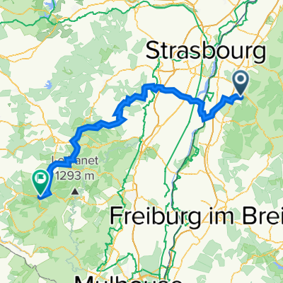
Zell-Weierbach - Schuckshof - Ortenberg - Kreuzung Hohes-Horn - Albersbach - Riedle - Zell-Weierbach
A cycling route starting in Ortenberg, Baden-Württemberg, Germany.
Overview
About this route
- ca. 265 Höhenmeter <br />- ca. 10 Kilometer <br />- 45 Minuten (12,6 km Schnitt - ohne Pausen) <br /><br />- Rastmöglichkeit: Schuckshof Weinstube (Fessenbach) <br />- Wassermöglichkeit: Quelle 10 Minuten vor Hohes-Horn Kreuzung
sehr gute kurze Trainingsrunde ode zum Workout geeignet
- -:--
- Duration
- 9.6 km
- Distance
- 489 m
- Ascent
- 489 m
- Descent
- ---
- Avg. speed
- ---
- Avg. speed
Route highlights
Points of interest along the route
Accommodation after 2.4 km
Schuckshof Weinstube
Photo after 4.4 km
Blick auf Offenburg, Straßburg, etc.
Point of interest after 5.5 km
Quelle
Point of interest after 7.4 km
Moosmättle
Continue with Bikemap
Use, edit, or download this cycling route
You would like to ride Zell-Weierbach - Schuckshof - Ortenberg - Kreuzung Hohes-Horn - Albersbach - Riedle - Zell-Weierbach or customize it for your own trip? Here is what you can do with this Bikemap route:
Free features
- Save this route as favorite or in collections
- Copy & plan your own version of this route
- Sync your route with Garmin or Wahoo
Premium features
Free trial for 3 days, or one-time payment. More about Bikemap Premium.
- Navigate this route on iOS & Android
- Export a GPX / KML file of this route
- Create your custom printout (try it for free)
- Download this route for offline navigation
Discover more Premium features.
Get Bikemap PremiumFrom our community
Other popular routes starting in Ortenberg
- Sattlerweg 2, Offenburg nach Blumenstraße 4A, Hohberg
- Distance
- 66.8 km
- Ascent
- 1,157 m
- Descent
- 1,150 m
- Location
- Ortenberg, Baden-Württemberg, Germany
- Elsass 2021
- Distance
- 297.1 km
- Ascent
- 434 m
- Descent
- 517 m
- Location
- Ortenberg, Baden-Württemberg, Germany
- Schönberg ( einfach )
- Distance
- 49.2 km
- Ascent
- 309 m
- Descent
- 308 m
- Location
- Ortenberg, Baden-Württemberg, Germany
- Deutschland rundum
- Distance
- 350.7 km
- Ascent
- 372 m
- Descent
- 180 m
- Location
- Ortenberg, Baden-Württemberg, Germany
- MTB-Strohbach
- Distance
- 30.5 km
- Ascent
- 495 m
- Descent
- 493 m
- Location
- Ortenberg, Baden-Württemberg, Germany
- Rund ums Geiger Köpfle
- Distance
- 41.3 km
- Ascent
- 235 m
- Descent
- 232 m
- Location
- Ortenberg, Baden-Württemberg, Germany
- Zell-Weierbach - Schuckshof - Ortenberg - Kreuzung Hohes-Horn - Albersbach - Riedle - Zell-Weierbach
- Distance
- 9.6 km
- Ascent
- 489 m
- Descent
- 489 m
- Location
- Ortenberg, Baden-Württemberg, Germany
- Ofg-Hausach-Gutach-Elzach-Kenzingen-Wyhl-Rust-Schwanau-Ofg
- Distance
- 176.3 km
- Ascent
- 969 m
- Descent
- 945 m
- Location
- Ortenberg, Baden-Württemberg, Germany
Open it in the app