

5 A/ Metz - do Campingu.
A cycling route starting in Saint-Julien-lès-Metz, Grand Est, France.
Overview
About this route
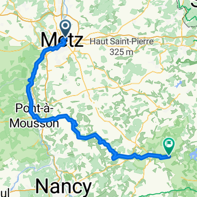
On the left side of the Moselle, take the D 1 to the second roundabout and 400 m further, cross the tracks, the stream La Seille, and along the bank to the bridge Rue du Pont des Morts, then to the campsite. About 4 km.
- -:--
- Duration
- 4 km
- Distance
- 21 m
- Ascent
- 17 m
- Descent
- ---
- Avg. speed
- ---
- Max. altitude

Route quality
Waytypes & surfaces along the route
Waytypes
Road
1.2 km
(29 %)
Quiet road
0.5 km
(12 %)
Surfaces
Paved
3.2 km
(79 %)
Asphalt
3 km
(76 %)
Concrete
0.1 km
(3 %)
Undefined
0.8 km
(21 %)
Continue with Bikemap
Use, edit, or download this cycling route
You would like to ride 5 A/ Metz - do Campingu. or customize it for your own trip? Here is what you can do with this Bikemap route:
Free features
- Save this route as favorite or in collections
- Copy & plan your own version of this route
- Sync your route with Garmin or Wahoo
Premium features
Free trial for 3 days, or one-time payment. More about Bikemap Premium.
- Navigate this route on iOS & Android
- Export a GPX / KML file of this route
- Create your custom printout (try it for free)
- Download this route for offline navigation
Discover more Premium features.
Get Bikemap PremiumFrom our community
Other popular routes starting in Saint-Julien-lès-Metz
 Metz-Bitche-Obersteinbach
- Distance
- 127.5 km
- Ascent
- 768 m
- Descent
- 753 m
- Location
- Saint-Julien-lès-Metz, Grand Est, France
 2025 3 Talange Trier
- Distance
- 112.9 km
- Ascent
- 506 m
- Descent
- 529 m
- Location
- Saint-Julien-lès-Metz, Grand Est, France
 Moselradweg bis Konztanz
- Distance
- 257.6 km
- Ascent
- 352 m
- Descent
- 443 m
- Location
- Saint-Julien-lès-Metz, Grand Est, France
 pourquoi ?
- Distance
- 19.1 km
- Ascent
- 150 m
- Descent
- 169 m
- Location
- Saint-Julien-lès-Metz, Grand Est, France
 5 A/ Metz do campingu przy Rue du Pont des Mort.
- Distance
- 2.9 km
- Ascent
- 17 m
- Descent
- 14 m
- Location
- Saint-Julien-lès-Metz, Grand Est, France
 Relaxed route in Corny-sur-Moselle
- Distance
- 31.8 km
- Ascent
- 146 m
- Descent
- 134 m
- Location
- Saint-Julien-lès-Metz, Grand Est, France
 B2/C3 Metz-Koblenz
- Distance
- 308.1 km
- Ascent
- 80 m
- Descent
- 180 m
- Location
- Saint-Julien-lès-Metz, Grand Est, France
 SaarLux 1/4
- Distance
- 102.3 km
- Ascent
- 602 m
- Descent
- 559 m
- Location
- Saint-Julien-lès-Metz, Grand Est, France
Open it in the app