

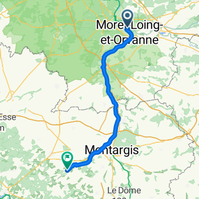
Moret - Fontainebleau
A cycling route starting in Saint-Mammès, Île-de-France Region, France.
Overview
About this route
veneux-moret-saint mammes-champagne-thomery-avon-fontainebleau
- -:--
- Duration
- 17.2 km
- Distance
- 159 m
- Ascent
- 152 m
- Descent
- ---
- Avg. speed
- ---
- Max. altitude

Route quality
Waytypes & surfaces along the route
Waytypes
Road
6.9 km
(40 %)
Track
2.1 km
(12 %)
Surfaces
Paved
6.2 km
(36 %)
Unpaved
0.2 km
(1 %)
Asphalt
6.2 km
(36 %)
Gravel
0.2 km
(1 %)
Undefined
10.9 km
(63 %)
Continue with Bikemap
Use, edit, or download this cycling route
You would like to ride Moret - Fontainebleau or customize it for your own trip? Here is what you can do with this Bikemap route:
Free features
- Save this route as favorite or in collections
- Copy & plan your own version of this route
- Sync your route with Garmin or Wahoo
Premium features
Free trial for 3 days, or one-time payment. More about Bikemap Premium.
- Navigate this route on iOS & Android
- Export a GPX / KML file of this route
- Create your custom printout (try it for free)
- Download this route for offline navigation
Discover more Premium features.
Get Bikemap PremiumFrom our community
Other popular routes starting in Saint-Mammès
 De Quai du Loing 10, Saint-Mammès à Château - Etangs, Cepoy
- Distance
- 47.6 km
- Ascent
- 241 m
- Descent
- 208 m
- Location
- Saint-Mammès, Île-de-France Region, France
 St Mammes - Orléans
- Distance
- 134.3 km
- Ascent
- 148 m
- Descent
- 86 m
- Location
- Saint-Mammès, Île-de-France Region, France
 Paris_05-mod
- Distance
- 88.6 km
- Ascent
- 316 m
- Descent
- 302 m
- Location
- Saint-Mammès, Île-de-France Region, France
 Veneux-les-Sablons - Crancey
- Distance
- 84.6 km
- Ascent
- 467 m
- Descent
- 462 m
- Location
- Saint-Mammès, Île-de-France Region, France
 Moret - Fontainebleau
- Distance
- 17.2 km
- Ascent
- 159 m
- Descent
- 152 m
- Location
- Saint-Mammès, Île-de-France Region, France
 Piste de chamapgne
- Distance
- 5.5 km
- Ascent
- 59 m
- Descent
- 61 m
- Location
- Saint-Mammès, Île-de-France Region, France
 Moret-Montereau-st mammes-champagne-thomery
- Distance
- 39 km
- Ascent
- 238 m
- Descent
- 241 m
- Location
- Saint-Mammès, Île-de-France Region, France
 Saint-Mammès - Lorris
- Distance
- 70.8 km
- Ascent
- 312 m
- Descent
- 248 m
- Location
- Saint-Mammès, Île-de-France Region, France
Open it in the app