

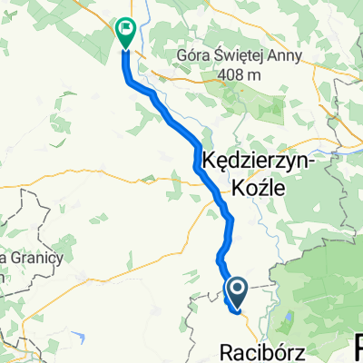
Łaziska Średnie - Sławików
A cycling route starting in Rudnik, Silesian Voivodeship, Poland.
Overview
About this route
- -:--
- Duration
- 78.1 km
- Distance
- 313 m
- Ascent
- 256 m
- Descent
- ---
- Avg. speed
- ---
- Max. altitude

Route quality
Waytypes & surfaces along the route
Waytypes
Road
15.6 km
(20 %)
Track
6.3 km
(8 %)
Surfaces
Paved
64.9 km
(83 %)
Unpaved
5.5 km
(7 %)
Asphalt
63.3 km
(81 %)
Gravel
3.1 km
(4 %)
Route highlights
Points of interest along the route
Point of interest after 11.7 km
Continue with Bikemap
Use, edit, or download this cycling route
You would like to ride Łaziska Średnie - Sławików or customize it for your own trip? Here is what you can do with this Bikemap route:
Free features
- Save this route as favorite or in collections
- Copy & plan your own version of this route
- Sync your route with Garmin or Wahoo
Premium features
Free trial for 3 days, or one-time payment. More about Bikemap Premium.
- Navigate this route on iOS & Android
- Export a GPX / KML file of this route
- Create your custom printout (try it for free)
- Download this route for offline navigation
Discover more Premium features.
Get Bikemap PremiumFrom our community
Other popular routes starting in Rudnik
 FichBalaton 2009 4. Etappe
- Distance
- 243.9 km
- Ascent
- 1,998 m
- Descent
- 1,955 m
- Location
- Rudnik, Silesian Voivodeship, Poland
 Łaziska Średnie - Sławików
- Distance
- 78.1 km
- Ascent
- 313 m
- Descent
- 256 m
- Location
- Rudnik, Silesian Voivodeship, Poland
 Rudnicka 2, Pawłów do Powstańców Śląskich 40A, Pawłów
- Distance
- 38.1 km
- Ascent
- 270 m
- Descent
- 267 m
- Location
- Rudnik, Silesian Voivodeship, Poland
 Do Opola odcinek 2
- Distance
- 50.4 km
- Ascent
- 585 m
- Descent
- 668 m
- Location
- Rudnik, Silesian Voivodeship, Poland
 Raciborz w deszczu
- Distance
- 13 km
- Ascent
- 65 m
- Descent
- 61 m
- Location
- Rudnik, Silesian Voivodeship, Poland
 Powstańców Śląskich 40A, Pawłów do Powstańców Śląskich 40A, Pawłów
- Distance
- 15.7 km
- Ascent
- 119 m
- Descent
- 118 m
- Location
- Rudnik, Silesian Voivodeship, Poland
 Nowa 22, Rudnik do Strzelecka 4, Góra Świętej Anny
- Distance
- 45.8 km
- Ascent
- 297 m
- Descent
- 143 m
- Location
- Rudnik, Silesian Voivodeship, Poland
 Wyzwolenia 3b, Modzurów do Koszalińska 45, Racibórz
- Distance
- 12.8 km
- Ascent
- 96 m
- Descent
- 155 m
- Location
- Rudnik, Silesian Voivodeship, Poland
Open it in the app