

Col Donon-Obernai
A cycling route starting in Schirmeck, Grand Est, France.
Overview
About this route
Čím více zde napíšete informací, tím více bude užitečnější pro ostatním uživatele.<br /> <br /> * Průběh trasy.<br /> * Co je zvláštní na této trase?<br /> * Proč doporučit tuto trasu?<br /> * Co se Vám zde nejvíce líbilo?<br /> * Atd.
- -:--
- Duration
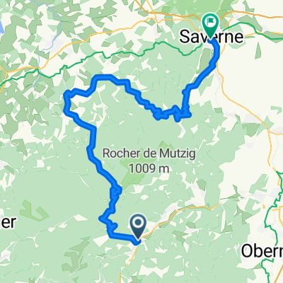
- 51.7 km
- Distance
- 210 m
- Ascent
- 957 m
- Descent
- ---
- Avg. speed
- ---
- Max. altitude
Route quality
Waytypes & surfaces along the route
Waytypes
Busy road
33.3 km
(64 %)
Quiet road
6.5 km
(13 %)
Surfaces
Paved
33 km
(64 %)
Unpaved
1.7 km
(3 %)
Asphalt
32.3 km
(62 %)
Ground
1.5 km
(3 %)
Continue with Bikemap
Use, edit, or download this cycling route
You would like to ride Col Donon-Obernai or customize it for your own trip? Here is what you can do with this Bikemap route:
Free features
- Save this route as favorite or in collections
- Copy & plan your own version of this route
- Sync your route with Garmin or Wahoo
Premium features
Free trial for 3 days, or one-time payment. More about Bikemap Premium.
- Navigate this route on iOS & Android
- Export a GPX / KML file of this route
- Create your custom printout (try it for free)
- Download this route for offline navigation
Discover more Premium features.
Get Bikemap PremiumFrom our community
Other popular routes starting in Schirmeck
 Schirmeck - Col de Donon - Saverne
- Distance
- 83.9 km
- Ascent
- 1,072 m
- Descent
- 1,172 m
- Location
- Schirmeck, Grand Est, France
 Tour Haute vallée de la Bruche
- Distance
- 70.3 km
- Ascent
- 1,218 m
- Descent
- 1,185 m
- Location
- Schirmeck, Grand Est, France
 Col Donon-Obernai
- Distance
- 51.7 km
- Ascent
- 210 m
- Descent
- 957 m
- Location
- Schirmeck, Grand Est, France
 D2420 181, Schirmeck naar D261 54, La Broque
- Distance
- 70.3 km
- Ascent
- 35 m
- Descent
- 34 m
- Location
- Schirmeck, Grand Est, France
 MTB-Donon-55km
- Distance
- 54.4 km
- Ascent
- 1,878 m
- Descent
- 2,146 m
- Location
- Schirmeck, Grand Est, France
 Sortie Donon et petites routes forestières
- Distance
- 120.2 km
- Ascent
- 2,622 m
- Descent
- 2,622 m
- Location
- Schirmeck, Grand Est, France
 Schirmeck
- Distance
- 103.7 km
- Ascent
- 1,469 m
- Descent
- 1,590 m
- Location
- Schirmeck, Grand Est, France
 Une Rose Un Espoir, samedi 26 avril 2014
- Distance
- 138.4 km
- Ascent
- 1,855 m
- Descent
- 1,851 m
- Location
- Schirmeck, Grand Est, France
Open it in the app