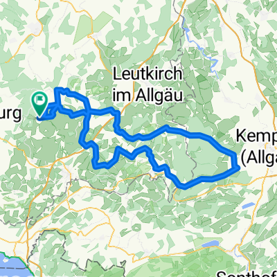
Pfänderrunde von Vogt
A cycling route starting in Vogt, Baden-Württemberg, Germany.
Overview
About this route
Vogt - Lochau - Pfänder - Scheidegg -Vogt
105km und 1650HM.
- -:--
- Duration
- 103.9 km
- Distance
- 929 m
- Ascent
- 929 m
- Descent
- ---
- Avg. speed
- ---
- Avg. speed
Route quality
Waytypes & surfaces along the route
Waytypes
Quiet road
47 km
(45 %)
Road
25.8 km
(25 %)
Surfaces
Paved
86.6 km
(83 %)
Unpaved
0.7 km
(<1 %)
Asphalt
86.6 km
(83 %)
Gravel
0.3 km
(<1 %)
Continue with Bikemap
Use, edit, or download this cycling route
You would like to ride Pfänderrunde von Vogt or customize it for your own trip? Here is what you can do with this Bikemap route:
Free features
- Save this route as favorite or in collections
- Copy & plan your own version of this route
- Sync your route with Garmin or Wahoo
Premium features
Free trial for 3 days, or one-time payment. More about Bikemap Premium.
- Navigate this route on iOS & Android
- Export a GPX / KML file of this route
- Create your custom printout (try it for free)
- Download this route for offline navigation
Discover more Premium features.
Get Bikemap PremiumFrom our community
Other popular routes starting in Vogt
- Rund um Vogt
- Distance
- 551.1 km
- Ascent
- 2,038 m
- Descent
- 2,017 m
- Location
- Vogt, Baden-Württemberg, Germany
- 24.08.2020 33 Seen-Weiher-Tour
- Distance
- 98 km
- Ascent
- 1,367 m
- Descent
- 1,367 m
- Location
- Vogt, Baden-Württemberg, Germany
- Vogter Runde
- Distance
- 47.2 km
- Ascent
- 1,470 m
- Descent
- 1,468 m
- Location
- Vogt, Baden-Württemberg, Germany
- Allgäutour
- Distance
- 113.9 km
- Ascent
- 625 m
- Descent
- 625 m
- Location
- Vogt, Baden-Württemberg, Germany
- Durch das württembergische Allgäü
- Distance
- 66.1 km
- Ascent
- 420 m
- Descent
- 421 m
- Location
- Vogt, Baden-Württemberg, Germany
- Grüner Baum-St, Gallen
- Distance
- 79.5 km
- Ascent
- 830 m
- Descent
- 771 m
- Location
- Vogt, Baden-Württemberg, Germany
- 1. OB Ritt Tag 1 und 3
- Distance
- 47.3 km
- Ascent
- 517 m
- Descent
- 529 m
- Location
- Vogt, Baden-Württemberg, Germany
- Pfänderrunde von Vogt
- Distance
- 103.9 km
- Ascent
- 929 m
- Descent
- 929 m
- Location
- Vogt, Baden-Württemberg, Germany
Open it in the app