

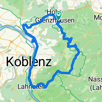
Höhr - Lahntal -Rheintal -Höhr
A cycling route starting in Höhr-Grenzhausen, Rhineland-Palatinate, Germany.
Overview
About this route
- -:--
- Duration
- 48.5 km
- Distance
- 815 m
- Ascent
- 961 m
- Descent
- ---
- Avg. speed
- 321 m
- Max. altitude
Route quality
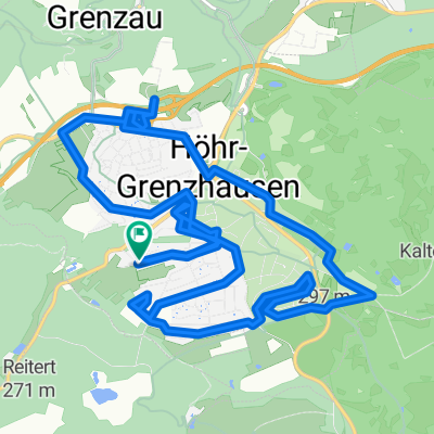
Waytypes & surfaces along the route
Waytypes
Road
15 km
(31 %)
Quiet road
8.2 km
(17 %)
Surfaces
Paved
23.8 km
(49 %)
Unpaved
4.4 km
(9 %)
Asphalt
23.3 km
(48 %)
Gravel
2.4 km
(5 %)
Continue with Bikemap
Use, edit, or download this cycling route
You would like to ride Höhr - Lahntal -Rheintal -Höhr or customize it for your own trip? Here is what you can do with this Bikemap route:
Free features
- Save this route as favorite or in collections
- Copy & plan your own version of this route
- Sync your route with Garmin or Wahoo
Premium features
Free trial for 3 days, or one-time payment. More about Bikemap Premium.
- Navigate this route on iOS & Android
- Export a GPX / KML file of this route
- Create your custom printout (try it for free)
- Download this route for offline navigation
Discover more Premium features.
Get Bikemap PremiumFrom our community
Other popular routes starting in Höhr-Grenzhausen
 Rund um Simmern2
- Distance
- 56.1 km
- Ascent
- 394 m
- Descent
- 398 m
- Location
- Höhr-Grenzhausen, Rhineland-Palatinate, Germany
 Rheinstraße nach Rheinstraße
- Distance
- 16.1 km
- Ascent
- 198 m
- Descent
- 245 m
- Location
- Höhr-Grenzhausen, Rhineland-Palatinate, Germany
 Rheinstraße nach Rheinstraße
- Distance
- 17.4 km
- Ascent
- 214 m
- Descent
- 264 m
- Location
- Höhr-Grenzhausen, Rhineland-Palatinate, Germany
 Rheinstraße nach Rheinstraße
- Distance
- 14.1 km
- Ascent
- 182 m
- Descent
- 236 m
- Location
- Höhr-Grenzhausen, Rhineland-Palatinate, Germany
 Rheinstraße nach Rheinstraße
- Distance
- 29.6 km
- Ascent
- 443 m
- Descent
- 502 m
- Location
- Höhr-Grenzhausen, Rhineland-Palatinate, Germany
 Ruhige Route
- Distance
- 17.6 km
- Ascent
- 246 m
- Descent
- 294 m
- Location
- Höhr-Grenzhausen, Rhineland-Palatinate, Germany
 Höhr - Lahntal -Rheintal -Höhr
- Distance
- 48.5 km
- Ascent
- 815 m
- Descent
- 961 m
- Location
- Höhr-Grenzhausen, Rhineland-Palatinate, Germany
 Rheinstraße nach Adolph-Kolping-Straße
- Distance
- 34.7 km
- Ascent
- 220 m
- Descent
- 427 m
- Location
- Höhr-Grenzhausen, Rhineland-Palatinate, Germany
Open it in the app